Moca night lights from space
Night Light of Moca (Espaillat) from space (Dominican Republic) Src. Average luminocity for 10x10km area is 43.8161% and for 50x50km: 17.9356%.
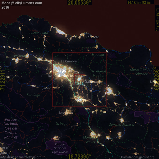
Analysis of Moca night lights 2016
Square area 10x10 km:
 3.93%
3.93%90-99
4.13%80-89
1.86%70-79
4.13%60-69
8.26%50-59
6.61%40-49
11.98%30-39
31.2%20-29
20.25%10-19
7.64%0-9
0%Square area 50x50 km:
1.93%90-99
2.38%80-89
1.92%70-79
2.14%60-69
3.27%50-59
2.42%40-49
3.51%30-39
4.37%20-29
5.04%10-19
11.92%0-9
61.09%Clear (daylight) street map image can be seen on geolist.org.
Map coordinates:
20° 3' 19.4" North, 71° 13' 44.8" West
19° 23' 36.7" North, 70° 31' 33.5" West
18° 43' 44.2" North, 69° 49' 22.3" West
Some cities around Moca sort by population:
• Santiago de los Caballeros
19.1 km =11.9 mi,  289°
289°
• Concepción de La Vega
19.1 km =11.9 mi,  181°
181°
• Salcedo
11.5 km =7.1 mi,  98°
98°
• Tamboril
13.6 km =8.5 mi,  318°
318°
• Salsipuedes
15.4 km =9.6 mi,  85°
85°
• Tenares
18.5 km =11.5 mi, 96°
• Licey al Medio
8.9 km =5.5 mi,  299°
299°
• San Víctor Arriba
9.4 km =5.8 mi,  353°
353°
3496331 (p: 61,834)
Sources (retrieved 2019-11-25):
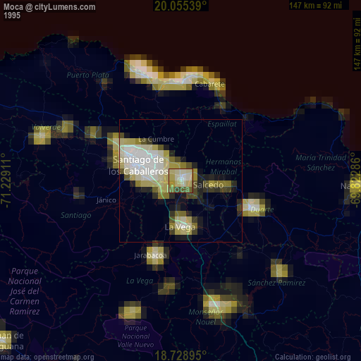
» NASA, Earths city lights 1995
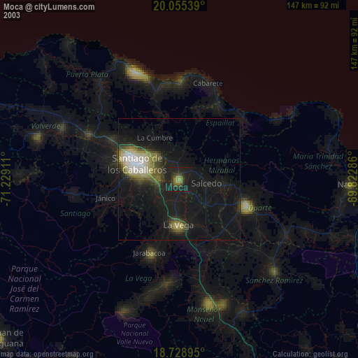
» NASA city lights 2003
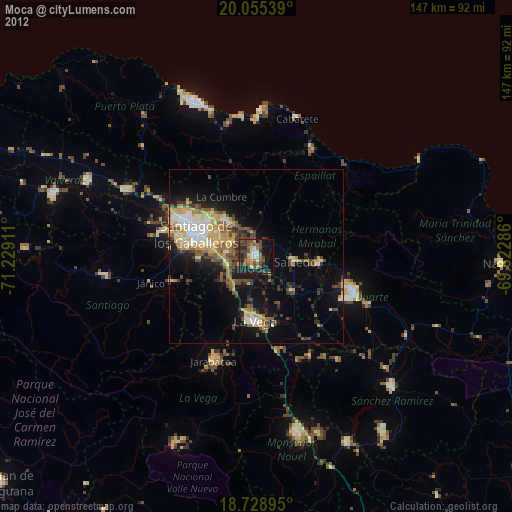
» Earth at Night: Flat Maps 2012, 2016