Puerto Plata night lights from space
Night Light of Puerto Plata from space (Dominican Republic) Src. Average luminocity for 10x10km area is 37.8822% and for 50x50km: 4.0392%.
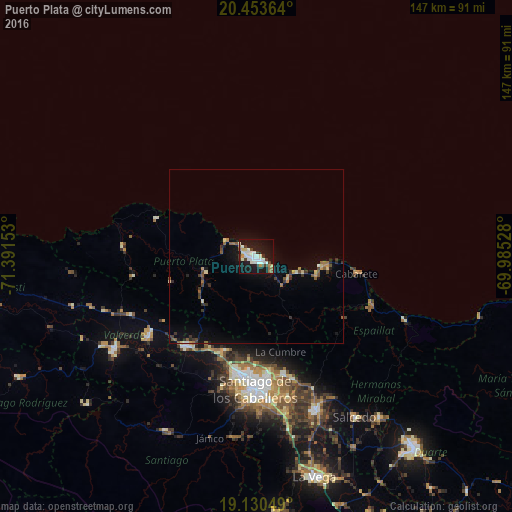
Analysis of Puerto Plata night lights 2016
Square area 10x10 km:
 10.54%
90-99
10.54%80-89
2.89%70-79
1.65%60-69
3.1%50-59
0.83%40-49
2.27%30-39
6.4%20-29
1.86%10-19
47.93%0-9
11.98%Square area 50x50 km:
0.45%90-99
0.53%80-89
0.4%70-79
0.31%60-69
0.45%50-59
0.54%40-49
0.47%30-39
0.92%20-29
0.47%10-19
3.35%0-9
92.1%Clear (daylight) street map image can be seen on geolist.org.
Map coordinates:
20° 27' 13.1" North, 71° 23' 29.5" West
19° 47' 36.4" North, 70° 41' 18.2" West
19° 7' 49.8" North, 69° 59' 7" West
Some cities around Puerto Plata sort by population:
• Santiago de los Caballeros
38 km =23.6 mi,  181°
181°
• Villa Bisonó
32.2 km =20 mi,  217°
217°
• Tamboril
35.2 km =21.9 mi,  166°
166°
• Río Grande
16.3 km =10.1 mi,  210°
210°
• Monte Llano
11.4 km =7.1 mi,  125°
125°
• Villa González
30 km =18.6 mi,  200°
200°
• Imbert
15.4 km =9.6 mi,  253°
253°
• Sosúa
18.2 km =11.3 mi,  104°
104°
3493175 (p: 146,000)
Sources (retrieved 2019-11-25):
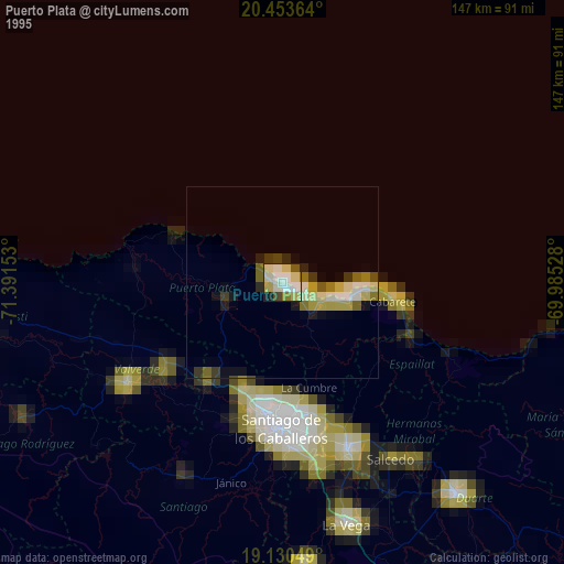
» NASA, Earths city lights 1995
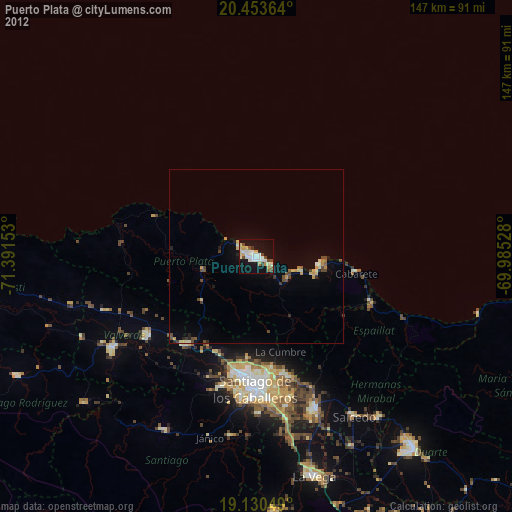
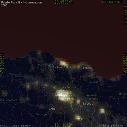
» NASA city lights 2003
» Earth at Night: Flat Maps 2012, 2016