Piedra Blanca night lights from space
Night Light of Piedra Blanca (Monseñor Nouel) from space (Dominican Republic) Src. Average luminocity for 10x10km area is 5.4026% and for 50x50km: 4.0834%.
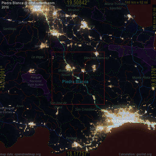
Analysis of Piedra Blanca night lights 2016
Square area 10x10 km:
 0%
0%90-99
0.65%80-89
0.87%70-79
0.22%60-69
0%50-59
0.87%40-49
0%30-39
2.6%20-29
2.6%10-19
0.87%0-9
91.34%Square area 50x50 km:
0.26%90-99
0.53%80-89
0.54%70-79
0.23%60-69
0.82%50-59
0.54%40-49
0.51%30-39
1.09%20-29
0.63%10-19
2.04%0-9
92.8%Clear (daylight) street map image can be seen on geolist.org.
Map coordinates:
19° 30' 30.3" North, 71° 1' 12" West
18° 50' 39.5" North, 70° 19' 0.8" West
18° 10' 39.3" North, 69° 36' 49.5" West
Some cities around Piedra Blanca sort by population:
• Bonao
14.2 km =8.8 mi,  316°
316°
• Cotuí
29.1 km =18.1 mi,  37°
37°
• Villa Altagracia
24.5 km =15.2 mi,  141°
141°
• Yamasá
31.6 km =19.6 mi,  104°
104°
• Fantino
30.9 km =19.2 mi,  3°
3°
• Jima Abajo
32.7 km =20.3 mi,  349°
349°
• Rincón
32 km =19.9 mi,  342°
342°
• Esperalvillo
29.8 km =18.5 mi, 96°
3494863 (p: 8,531)
Sources (retrieved 2019-11-25):
» Earth at Night: Flat Maps 2012, 2016