Bonao night lights from space
Night Light of Bonao (Monseñor Nouel) from space (Dominican Republic) Src. Average luminocity for 10x10km area is 31.2879% and for 50x50km: 4.6304%.
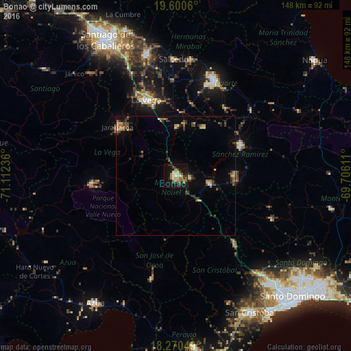

Analysis of Bonao night lights 2016
Square area 10x10 km:
 1.95%
1.95%90-99
4.76%80-89
5.84%70-79
0.65%60-69
9.74%50-59
4.76%40-49
3.25%30-39
6.71%20-29
3.25%10-19
34.42%0-9
24.68%Square area 50x50 km:
0.17%90-99
0.48%80-89
0.51%70-79
0.51%60-69
0.92%50-59
0.59%40-49
0.75%30-39
1.36%20-29
0.88%10-19
2.16%0-9
91.66%Clear (daylight) street map image can be seen on geolist.org.
Map coordinates:
19° 36' 2.2" North, 71° 6' 44.5" West
18° 56' 12.7" North, 70° 24' 33.2" West
18° 16' 13.8" North, 69° 42' 22" West
Some cities around Bonao sort by population:
• Concepción de La Vega
34.1 km =21.2 mi,  338°
338°
• Cotuí
30.2 km =18.8 mi,  64°
64°
• Jarabacoa
31.1 km =19.3 mi,  310°
310°
• Constanza
35.4 km =22 mi,  265°
265°
• Fantino
23.5 km =14.6 mi,  29°
29°
• Piedra Blanca
14.2 km =8.8 mi,  136°
136°
• Jima Abajo
22.1 km =13.7 mi,  9°
9°
• Rincón
20.3 km =12.6 mi,  0°
0°
3511233 (p: 73,269)
Sources (retrieved 2019-11-25):
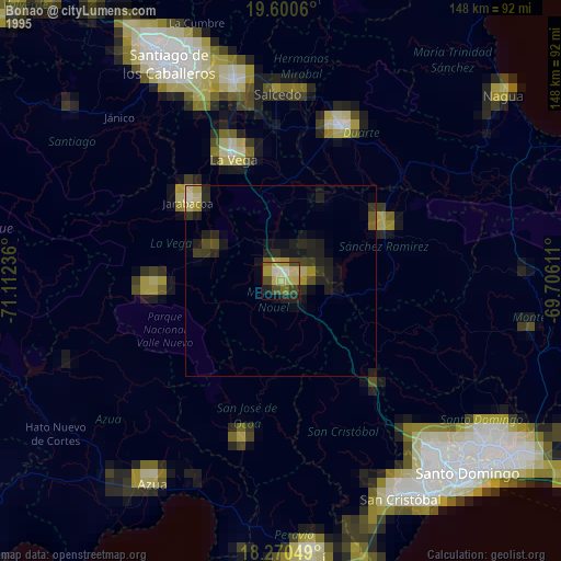
» NASA, Earths city lights 1995
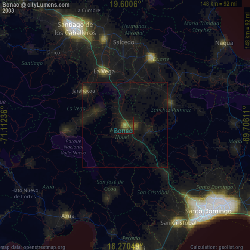
» NASA city lights 2003
» Earth at Night: Flat Maps 2012, 2016