Monción night lights from space
Night Light of Monción (Santiago Rodríguez) from space (Dominican Republic) Src. Average luminocity for 10x10km area is 4.2748% and for 50x50km: 2.7215%.
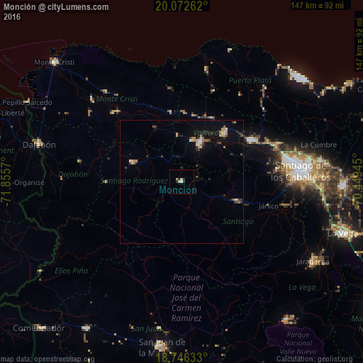
Analysis of Monción night lights 2016
Square area 10x10 km:
 0%
0%90-99
0.83%80-89
2.48%70-79
0%60-69
0%50-59
0%40-49
0%30-39
0.62%20-29
1.45%10-19
1.24%0-9
93.39%Square area 50x50 km:
0.14%90-99
0.37%80-89
0.24%70-79
0.53%60-69
0.34%50-59
0.19%40-49
0.36%30-39
0.6%20-29
0.45%10-19
1.35%0-9
95.42%Clear (daylight) street map image can be seen on geolist.org.
Map coordinates:
20° 4' 21.4" North, 71° 51' 20.5" West
19° 24' 39" North, 71° 9' 9.3" West
18° 44' 46.8" North, 70° 26' 58" West
Some cities around Monción sort by population:
• Mao
17.5 km =10.9 mi,  26°
26°
• Esperanza
26.1 km =16.2 mi,  42°
42°
• Villa Bisonó
33.6 km =20.9 mi,  59°
59°
• Sabaneta
21.1 km =13.1 mi,  290°
290°
• Villa González
40.8 km =25.4 mi,  69°
69°
• San José de Las Matas
23.9 km =14.9 mi,  109°
109°
• Laguna Salada
27.6 km =17.1 mi,  15°
15°
• Sabana Iglesia
42.4 km =26.3 mi,  103°
103°
3496284 (p: 6,625)
Sources (retrieved 2019-11-25):
» Earth at Night: Flat Maps 2012, 2016