Sabaneta night lights from space
Night Light of Sabaneta (Santiago Rodríguez) from space (Dominican Republic) Src. Average luminocity for 10x10km area is 5.5455% and for 50x50km: 1.4502%.
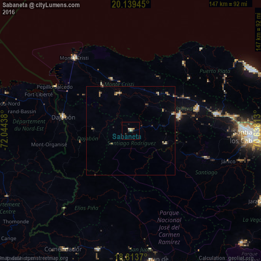
Analysis of Sabaneta night lights 2016
Square area 10x10 km:
 0%
0%90-99
0.83%80-89
1.65%70-79
0.83%60-69
1.65%50-59
0%40-49
0.21%30-39
1.45%20-29
0%10-19
1.65%0-9
91.74%Square area 50x50 km:
0%90-99
0.16%80-89
0.35%70-79
0.24%60-69
0.24%50-59
0.14%40-49
0.15%30-39
0.32%20-29
0.19%10-19
0.48%0-9
97.73%Clear (daylight) street map image can be seen on geolist.org.
Map coordinates:
20° 8' 22" North, 72° 2' 39.8" West
19° 28' 40.5" North, 71° 20' 28.5" West
18° 48' 49.3" North, 70° 38' 17.3" West
Some cities around Sabaneta sort by population:
• Mao
28.8 km =17.9 mi,  73°
73°
• Esperanza
39.2 km =24.4 mi, 72°
• Dajabón
39.3 km =24.4 mi,  281°
281°
• Villa Vásquez
31.3 km =19.4 mi,  339°
339°
• Las Matas de Santa Cruz
27.5 km =17.1 mi,  321°
321°
• Laguna Salada
33.1 km =20.6 mi,  54°
54°
• Loma de Cabrera
27.6 km =17.1 mi,  259°
259°
• Monción
21.1 km =13.1 mi,  110°
110°
3493383 (p: 16,380)
Sources (retrieved 2019-11-25):
» Earth at Night: Flat Maps 2012, 2016