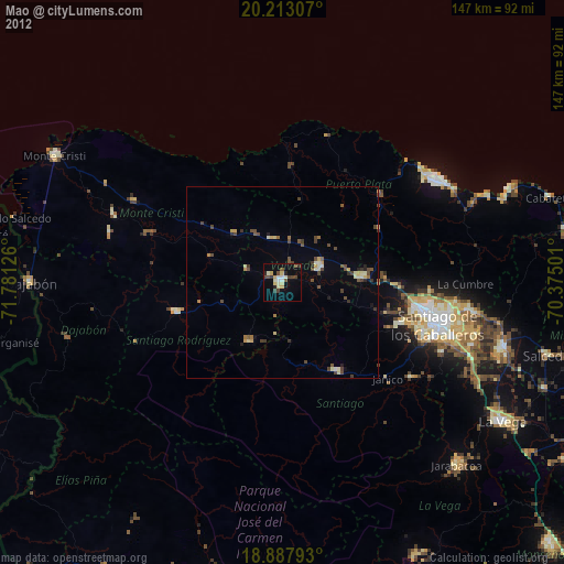
Mao night lights from space
Night Light of Mao (Valverde) from space (Dominican Republic) Src. Average luminocity for 10x10km area is 23.0702% and for 50x50km: 4.1141%.
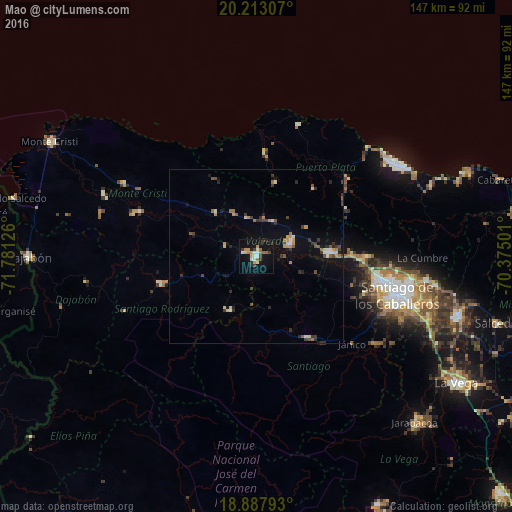
Analysis of Mao night lights 2016
Square area 10x10 km:
 2.07%
2.07%90-99
5.17%80-89
1.03%70-79
4.34%60-69
3.51%50-59
2.07%40-49
1.86%30-39
4.55%20-29
2.27%10-19
22.11%0-9
51.03%Square area 50x50 km:
0.27%90-99
0.54%80-89
0.3%70-79
0.61%60-69
0.57%50-59
0.5%40-49
0.54%30-39
1.01%20-29
0.78%10-19
2.19%0-9
92.68%Clear (daylight) street map image can be seen on geolist.org.
Map coordinates:
20° 12' 47.1" North, 71° 46' 52.5" West
19° 33' 6.7" North, 71° 4' 41.3" West
18° 53' 16.5" North, 70° 22' 30" West
Some cities around Mao sort by population:
• Esperanza
10.4 km =6.5 mi,  69°
69°
• Villa Bisonó
21.2 km =13.2 mi,  86°
86°
• Sabaneta
28.8 km =17.9 mi,  253°
253°
• Villa González
30.4 km =18.9 mi, 92°
• San José de Las Matas
27.8 km =17.3 mi,  148°
148°
• Imbert
34.4 km =21.4 mi,  49°
49°
• Laguna Salada
11 km =6.8 mi,  356°
356°
• Monción
17.5 km =10.9 mi,  206°
206°
3496831 (p: 48,297)
Sources (retrieved 2019-11-25):
» Earth at Night: Flat Maps 2012, 2016