Odense night lights from space
Night Light of Odense (South Denmark) from space (Denmark) Src. Average luminocity for 10x10km area is 64.4773% and for 50x50km: 5.2706%.
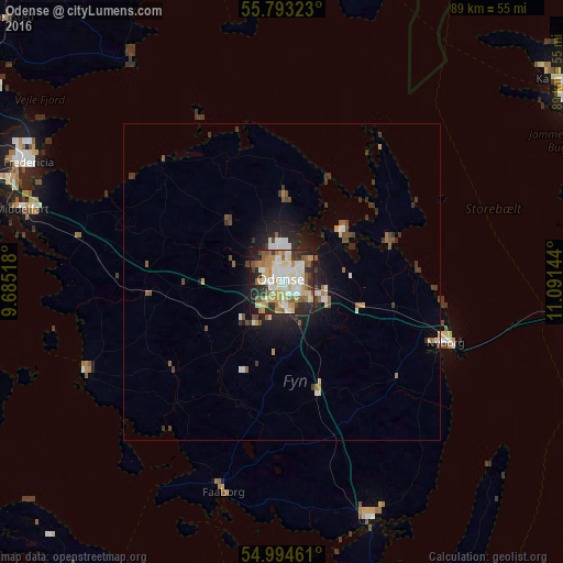
Analysis of Odense night lights 2016
Square area 10x10 km:
 14%
14%90-99
17.11%80-89
10.77%70-79
7.89%60-69
9.57%50-59
8.25%40-49
3.23%30-39
6.34%20-29
14.11%10-19
8.73%0-9
0%Square area 50x50 km:
0.83%90-99
0.94%80-89
0.58%70-79
0.49%60-69
0.59%50-59
0.77%40-49
0.65%30-39
1.09%20-29
1.43%10-19
2.83%0-9
89.81%Clear (daylight) street map image can be seen on geolist.org.
Map coordinates:
55° 47' 35.6" North, 9° 41' 6.6" East
55° 23' 45.4" North, 10° 23' 17.9" East
54° 59' 40.6" North, 11° 5' 29.2" East
Some cities around Odense sort by population:
• Svendborg
39.9 km =24.8 mi,  159°
159°
• Nyborg
27 km =16.8 mi,  110°
110°
• Middelfart
43.2 km =26.8 mi,  286°
286°
• Faaborg
34.7 km =21.6 mi,  195°
195°
• Assens
33.9 km =21.1 mi,  245°
245°
• Kerteminde
18 km =11.2 mi,  70°
70°
• Neder Holluf
5.2 km =3.2 mi,  132°
132°
• Munkebo
12.4 km =7.7 mi,  57°
57°
2615876 (p: 145,931)
Sources (retrieved 2019-11-25):
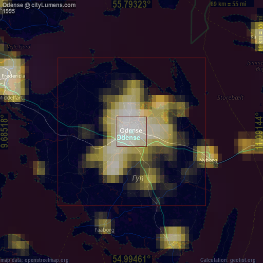
» NASA, Earths city lights 1995
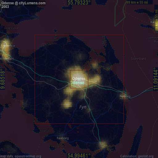
» NASA city lights 2003
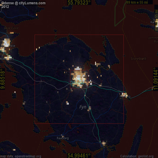
» Earth at Night: Flat Maps 2012, 2016