Kerteminde night lights from space
Night Light of Kerteminde (South Denmark) from space (Denmark) Src. Average luminocity for 10x10km area is 3.5313% and for 50x50km: 5.4684%.
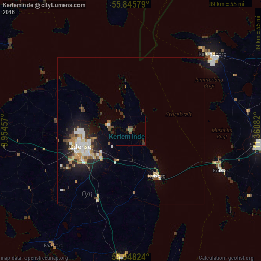
Analysis of Kerteminde night lights 2016
Square area 10x10 km:
 0%
0%90-99
0%80-89
0%70-79
0%60-69
0.75%50-59
1.25%40-49
1%30-39
2.51%20-29
1.75%10-19
0%0-9
92.73%Square area 50x50 km:
0.89%90-99
0.98%80-89
0.64%70-79
0.53%60-69
0.61%50-59
0.73%40-49
0.57%30-39
1.05%20-29
1.49%10-19
2.86%0-9
89.67%Clear (daylight) street map image can be seen on geolist.org.
Map coordinates:
55° 50' 44.8" North, 9° 57' 16.5" East
55° 26' 56.5" North, 10° 39' 27.7" East
55° 2' 53.7" North, 11° 21' 39" East
Some cities around Kerteminde sort by population:
• Odense
18 km =11.2 mi,  250°
250°
• Slagelse
44.3 km =27.5 mi,  96°
96°
• Svendborg
43.4 km =27 mi,  184°
184°
• Kalundborg
37.3 km =23.2 mi,  46°
46°
• Nyborg
17.3 km =10.7 mi,  151°
151°
• Korsør
33.1 km =20.6 mi,  113°
113°
• Neder Holluf
16.2 km =10.1 mi,  234°
234°
• Munkebo
6.6 km =4.1 mi,  276°
276°
2618944 (p: 5,748)
Sources (retrieved 2019-11-25):
» Earth at Night: Flat Maps 2012, 2016