Faaborg night lights from space
Night Light of Faaborg (South Denmark) from space (Denmark) Src. Average luminocity for 10x10km area is 2.2782% and for 50x50km: 0.9129%.
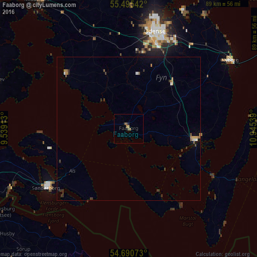
Analysis of Faaborg night lights 2016
Square area 10x10 km:
 0%
0%90-99
0%80-89
0%70-79
0.5%60-69
1.5%50-59
1%40-49
0%30-39
0%20-29
0.25%10-19
0.5%0-9
96.24%Square area 50x50 km:
0.09%90-99
0.05%80-89
0.06%70-79
0.13%60-69
0.22%50-59
0.18%40-49
0.05%30-39
0.34%20-29
0.11%10-19
0.09%0-9
98.67%Clear (daylight) street map image can be seen on geolist.org.
Map coordinates:
55° 29' 43.5" North, 9° 32' 20.9" East
55° 5' 42.4" North, 10° 14' 32.1" East
54° 41' 26.6" North, 10° 56' 43.4" East
Some cities around Faaborg sort by population:
• Odense
34.7 km =21.6 mi,  15°
15°
• Svendborg
23.5 km =14.6 mi,  99°
99°
• Sønderborg
35.5 km =22.1 mi,  234°
234°
• Nyborg
42.3 km =26.3 mi,  55°
55°
• Nordborg
32.2 km =20 mi,  262°
262°
• Assens
29.1 km =18.1 mi,  311°
311°
• Neder Holluf
32.7 km =20.3 mi, 23°
• Munkebo
44.7 km =27.8 mi,  26°
26°
2622383 (p: 7,239)
Sources (retrieved 2019-11-25):
» Earth at Night: Flat Maps 2012, 2016