Munkebo night lights from space
Night Light of Munkebo (South Denmark) from space (Denmark) Src. Average luminocity for 10x10km area is 8.0965% and for 50x50km: 5.5332%.
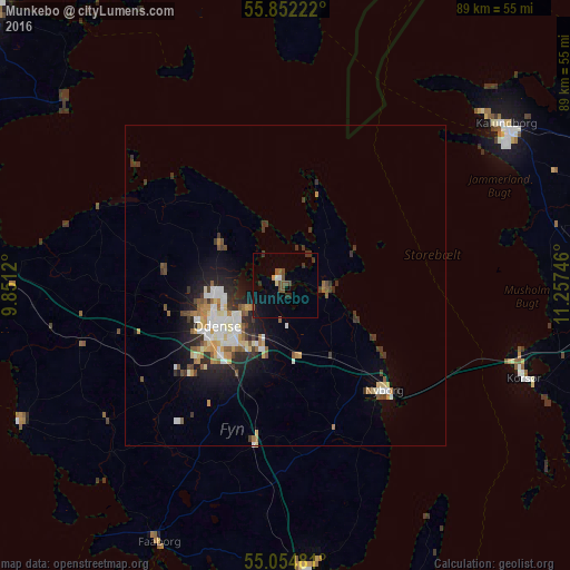
Analysis of Munkebo night lights 2016
Square area 10x10 km:
 0.75%
0.75%90-99
0.38%80-89
0.38%70-79
0.5%60-69
0%50-59
2.01%40-49
3.13%30-39
1.38%20-29
2.01%10-19
3.01%0-9
86.47%Square area 50x50 km:
0.88%90-99
0.98%80-89
0.63%70-79
0.55%60-69
0.61%50-59
0.75%40-49
0.63%30-39
1.17%20-29
1.46%10-19
2.86%0-9
89.49%Clear (daylight) street map image can be seen on geolist.org.
Map coordinates:
55° 51' 8" North, 9° 51' 4.3" East
55° 27' 19.9" North, 10° 33' 15.6" East
55° 3' 17.3" North, 11° 15' 26.9" East
Some cities around Munkebo sort by population:
• Odense
12.4 km =7.7 mi,  237°
237°
• Svendborg
44.1 km =27.4 mi,  175°
175°
• Kalundborg
41.8 km =26 mi,  53°
53°
• Nyborg
21.7 km =13.5 mi,  136°
136°
• Korsør
39.4 km =24.5 mi,  110°
110°
• Faaborg
44.7 km =27.8 mi,  206°
206°
• Kerteminde
6.6 km =4.1 mi,  96°
96°
• Neder Holluf
12.1 km =7.5 mi, 213°
2616672 (p: 5,225)
Sources (retrieved 2019-11-25):
» Earth at Night: Flat Maps 2012, 2016