Zell im Wiesental night lights from space
Night Light of Zell im Wiesental (Baden-Württemberg) from space (Germany) Src. Average luminocity for 10x10km area is 0.8661% and for 50x50km: 10.5846%.
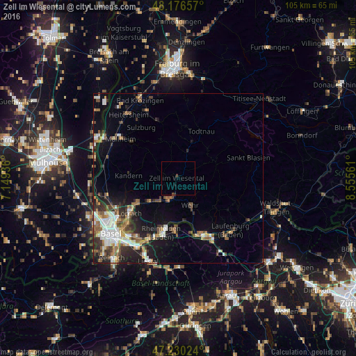
Analysis of Zell im Wiesental night lights 2016
Square area 10x10 km:
 0%
0%90-99
0%80-89
0%70-79
0%60-69
0%50-59
0%40-49
0.89%30-39
0.3%20-29
0%10-19
0.6%0-9
98.21%Square area 50x50 km:
1.83%90-99
1.84%80-89
0.75%70-79
1.12%60-69
1.29%50-59
1.99%40-49
1.43%30-39
1.66%20-29
2.6%10-19
5.47%0-9
80.03%Clear (daylight) street map image can be seen on geolist.org.
Map coordinates:
48° 10' 35.7" North, 7° 8' 57.7" East
47° 42' 20" North, 7° 51' 8.9" East
47° 13' 48.9" North, 8° 33' 20.2" East
Some cities around Zell im Wiesental sort by population:
• Lörrach
17.3 km =10.7 mi,  234°
234°
• Rheinfelden
16.9 km =10.5 mi,  196°
196°
• Schopfheim
6.5 km =4 mi, 201°
• Wehr
9.3 km =5.8 mi,  155°
155°
• Steinen
10.9 km =6.8 mi, 231°
• Möhlin, CH
16.3 km =10.1 mi,  182°
182°
• Kandern
14.3 km =8.9 mi,  273°
273°
• Todtnau
15.4 km =9.6 mi,  26°
26°
2804810 (p: 6,206)
Sources (retrieved 2019-11-25):
» Earth at Night: Flat Maps 2012, 2016