Rheinfelden night lights from space
Night Light of Rheinfelden (Baden-Württemberg) from space (Germany) Src. Average luminocity for 10x10km area is 23.3551% and for 50x50km: 14.8542%.
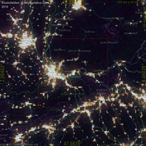
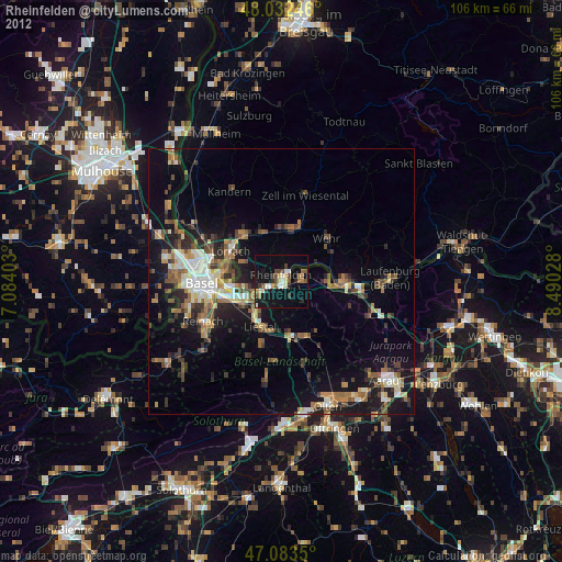
Analysis of Rheinfelden night lights 2016
Square area 10x10 km:
 2.84%
2.84%90-99
2.56%80-89
2.41%70-79
2.27%60-69
1.28%50-59
4.4%40-49
3.41%30-39
3.41%20-29
6.11%10-19
36.65%0-9
34.66%Square area 50x50 km:
2.04%90-99
2.37%80-89
1.05%70-79
1.64%60-69
1.99%50-59
2.44%40-49
2.2%30-39
2.43%20-29
4.28%10-19
11.33%0-9
68.23%Clear (daylight) street map image can be seen on geolist.org.
Map coordinates:
48° 1' 56.9" North, 7° 5' 2.5" East
47° 33' 36.5" North, 7° 47' 13.7" East
47° 5' 0.6" North, 8° 29' 25" East
Some cities around Rheinfelden sort by population:
• Riehen, CH
10.7 km =6.6 mi,  281°
281°
• Schopfheim
10.4 km =6.5 mi,  14°
14°
• Pratteln, CH
8.3 km =5.2 mi,  238°
238°
• Grenzach-Wyhlen
7.9 km =4.9 mi,  261°
261°
• Liestal, CH
9.3 km =5.8 mi,  205°
205°
• Steinen
10 km =6.2 mi,  338°
338°
• Möhlin, CH
4.2 km =2.6 mi,  91°
91°
• Frenkendorf, CH
8 km =5 mi,  221°
221°
2847639 (p: 32,535)
Sources (retrieved 2019-11-25):
» Earth at Night: Flat Maps 2012, 2016