Wetzendorf night lights from space
Night Light of Wetzendorf (Bavaria) from space (Germany) Src. Average luminocity for 10x10km area is 79.7983% and for 50x50km: 14.0693%.
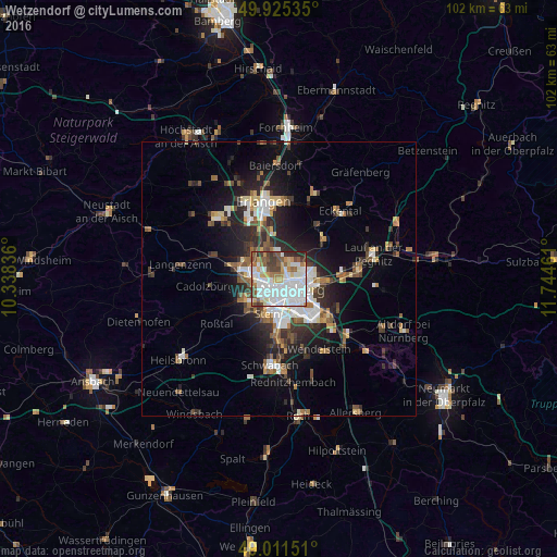
Analysis of Wetzendorf night lights 2016
Square area 10x10 km:
 35.01%
90-99
19.75%80-89
6.3%70-79
6.58%60-69
6.16%50-59
8.82%40-49
7.98%30-39
6.58%20-29
2.8%10-19
0%0-9
0%Square area 50x50 km:
2.85%90-99
2.33%80-89
1.17%70-79
1.18%60-69
1.67%50-59
2.06%40-49
2.01%30-39
2.19%20-29
4.45%10-19
7.52%0-9
72.57%Clear (daylight) street map image can be seen on geolist.org.
Map coordinates:
49° 55' 31.3" North, 10° 20' 18.1" East
49° 28' 14" North, 11° 2' 29.3" East
49° 0' 41.4" North, 11° 44' 40.6" East
Some cities around Wetzendorf sort by population:
• Nürnberg
3.2 km =2 mi,  124°
124°
• Fürth
3.9 km =2.4 mi,  278°
278°
• Zirndorf
7 km =4.3 mi,  243°
243°
• Oberasbach
8.1 km =5 mi,  228°
228°
• Stein
6.4 km =4 mi,  196°
196°
• Schwaig
11.5 km =7.1 mi,  90°
90°
• Heroldsberg
10.7 km =6.6 mi,  50°
50°
• Veitsbronn
12 km =7.5 mi,  292°
292°
2809897 (p: 8,268)
Sources (retrieved 2019-11-25):
» Earth at Night: Flat Maps 2012, 2016