Nürnberg night lights from space
Night Light of Nürnberg (Bavaria) from space (Germany) Src. Average luminocity for 10x10km area is 86.2843% and for 50x50km: 14.119%.
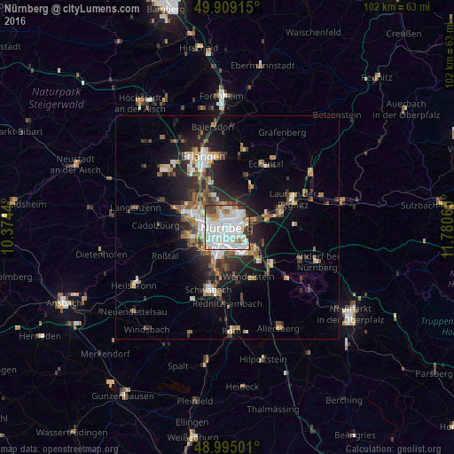
Analysis of Nürnberg night lights 2016
Square area 10x10 km:
 41.46%
90-99
27.45%80-89
6.16%70-79
4.62%60-69
5.74%50-59
3.08%40-49
3.78%30-39
5.04%20-29
2.66%10-19
0%0-9
0%Square area 50x50 km:
2.87%90-99
2.34%80-89
1.19%70-79
1.2%60-69
1.66%50-59
2.08%40-49
2.02%30-39
2.19%20-29
4.41%10-19
7.41%0-9
72.64%Clear (daylight) street map image can be seen on geolist.org.
Map coordinates:
49° 54' 32.9" North, 10° 22' 27.8" East
49° 27' 15.2" North, 11° 4' 39.1" East
48° 59' 42" North, 11° 46' 50.3" East
Some cities around Nürnberg sort by population:
• Fürth
6.9 km =4.3 mi,  290°
290°
• Zirndorf
9 km =5.6 mi,  261°
261°
• Oberasbach
9.3 km =5.8 mi,  248°
248°
• Stein
6.2 km =3.9 mi,  226°
226°
• Röthenbach an der Pegnitz
12.3 km =7.6 mi,  74°
74°
• Schwaig
9.1 km =5.7 mi,  79°
79°
• Wetzendorf
3.2 km =2 mi,  304°
304°
• Heroldsberg
10.4 km =6.5 mi,  32°
32°
2861650 (p: 499,237)
Sources (retrieved 2019-11-25):
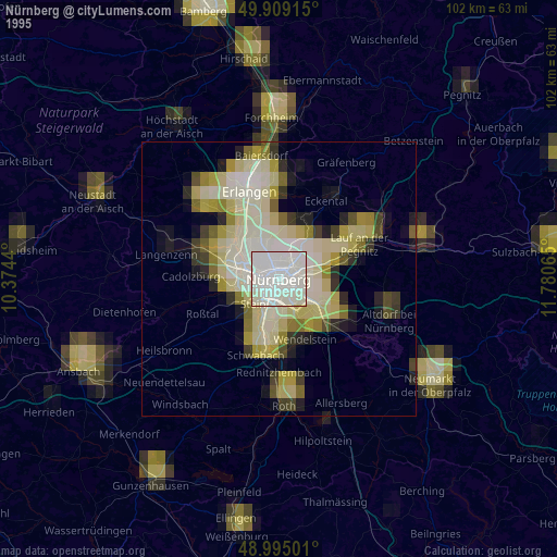
» NASA, Earths city lights 1995
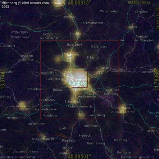
» NASA city lights 2003
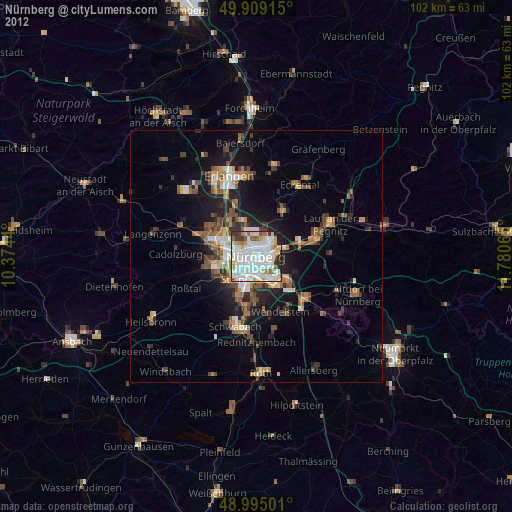
» Earth at Night: Flat Maps 2012, 2016