Wettringen night lights from space
Night Light of Wettringen (North Rhine-Westphalia) from space (Germany) Src. Average luminocity for 10x10km area is 2.0489% and for 50x50km: 5.6033%.
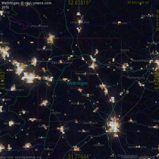
Analysis of Wettringen night lights 2016
Square area 10x10 km:
 0%
0%90-99
0%80-89
0%70-79
0%60-69
0%50-59
1.59%40-49
0%30-39
0.53%20-29
2.12%10-19
0.26%0-9
95.5%Square area 50x50 km:
0.47%90-99
0.56%80-89
0.42%70-79
0.48%60-69
0.93%50-59
1.16%40-49
0.95%30-39
0.89%20-29
0.95%10-19
3.55%0-9
89.63%Clear (daylight) street map image can be seen on geolist.org.
Map coordinates:
52° 38' 17.4" North, 6° 36' 57" East
52° 12' 33.8" North, 7° 19' 8.2" East
51° 46' 35.2" North, 8° 1' 19.5" East
Some cities around Wettringen sort by population:
• Rheine
11.8 km =7.3 mi,  44°
44°
• Steinfurt
6.7 km =4.2 mi,  169°
169°
• Ochtrup
8.8 km =5.5 mi,  269°
269°
• Neuenkirchen
5.3 km =3.3 mi, 42°
• Schüttorf
14.2 km =8.8 mi,  332°
332°
• Schöppingen
13.5 km =8.4 mi,  205°
205°
• Salzbergen
13.9 km =8.6 mi,  8°
8°
• Metelen
10.2 km =6.3 mi,  225°
225°
2809919 (p: 7,897)
Sources (retrieved 2019-11-25):
» Earth at Night: Flat Maps 2012, 2016