Ochtrup night lights from space
Night Light of Ochtrup (North Rhine-Westphalia) from space (Germany) Src. Average luminocity for 10x10km area is 3.6667% and for 50x50km: 7.2044%.
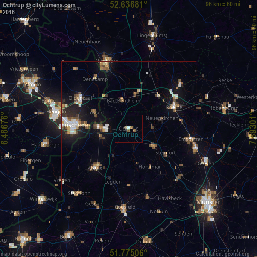
Analysis of Ochtrup night lights 2016
Square area 10x10 km:
 0.4%
0.4%90-99
0.13%80-89
0.53%70-79
0.26%60-69
0.79%50-59
1.59%40-49
0%30-39
0.53%20-29
0.53%10-19
0.93%0-9
94.31%Square area 50x50 km:
0.82%90-99
0.99%80-89
0.58%70-79
0.68%60-69
1.12%50-59
1.23%40-49
1.18%30-39
1%20-29
1.75%10-19
4.76%0-9
85.89%Clear (daylight) street map image can be seen on geolist.org.
Map coordinates:
52° 38' 12.5" North, 6° 29' 12.3" East
52° 12' 28.9" North, 7° 11' 23.6" East
51° 46' 30.2" North, 7° 53' 34.8" East
Some cities around Ochtrup sort by population:
• Gronau
11.4 km =7.1 mi,  271°
271°
• Steinfurt
11.9 km =7.4 mi,  122°
122°
• Bad Bentheim
10.5 km =6.5 mi,  347°
347°
• Schüttorf
12.9 km =8 mi,  9°
9°
• Heek
11.9 km =7.4 mi,  211°
211°
• Schöppingen
12.4 km =7.7 mi,  166°
166°
• Wettringen
8.8 km =5.5 mi,  89°
89°
• Metelen
7.2 km =4.5 mi, 167°
2858245 (p: 19,441)
Sources (retrieved 2019-11-25):
» Earth at Night: Flat Maps 2012, 2016