Rheine night lights from space
Night Light of Rheine (North Rhine-Westphalia) from space (Germany) Src. Average luminocity for 10x10km area is 16.6174% and for 50x50km: 4.1756%.
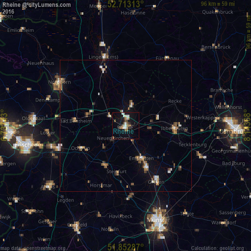
Analysis of Rheine night lights 2016
Square area 10x10 km:
 2.02%
2.02%90-99
3.41%80-89
1.14%70-79
0.13%60-69
3.03%50-59
3.28%40-49
0.63%30-39
2.02%20-29
2.78%10-19
16.67%0-9
64.9%Square area 50x50 km:
0.42%90-99
0.54%80-89
0.25%70-79
0.37%60-69
0.59%50-59
0.92%40-49
0.74%30-39
0.6%20-29
0.57%10-19
1.95%0-9
93.06%Clear (daylight) street map image can be seen on geolist.org.
Map coordinates:
52° 42' 47.3" North, 6° 44' 14.7" East
52° 17' 6.3" North, 7° 26' 26" East
51° 51' 10.3" North, 8° 8' 37.2" East
Some cities around Rheine sort by population:
• Emsdetten
13.8 km =8.6 mi,  154°
154°
• Hörstel
9.8 km =6.1 mi,  81°
81°
• Neuenkirchen
6.5 km =4 mi,  226°
226°
• Schüttorf
15.5 km =9.6 mi,  285°
285°
• Emsbüren
15.9 km =9.9 mi,  323°
323°
• Spelle
9.2 km =5.7 mi,  11°
11°
• Wettringen
11.8 km =7.3 mi,  224°
224°
• Salzbergen
8.2 km =5.1 mi,  311°
311°
2847645 (p: 76,491)
Sources (retrieved 2019-11-25):
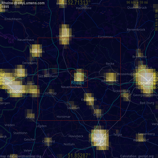
» NASA, Earths city lights 1995
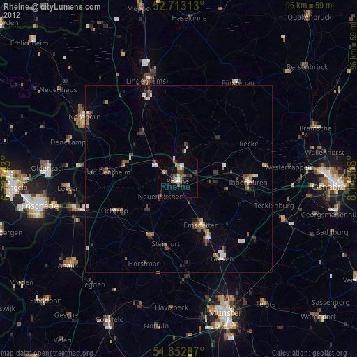
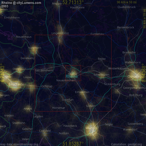
» NASA city lights 2003
» Earth at Night: Flat Maps 2012, 2016