Steinfurt night lights from space
Night Light of Steinfurt (North Rhine-Westphalia) from space (Germany) Src. Average luminocity for 10x10km area is 4.4921% and for 50x50km: 7.0051%.
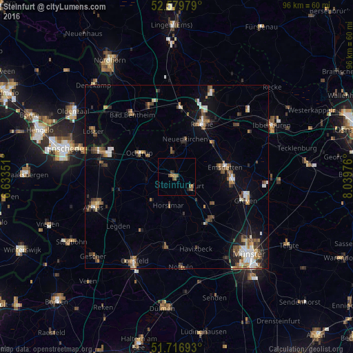
Analysis of Steinfurt night lights 2016
Square area 10x10 km:
 0%
0%90-99
0%80-89
0%70-79
0.66%60-69
1.46%50-59
1.98%40-49
1.72%30-39
0.66%20-29
0.79%10-19
0.13%0-9
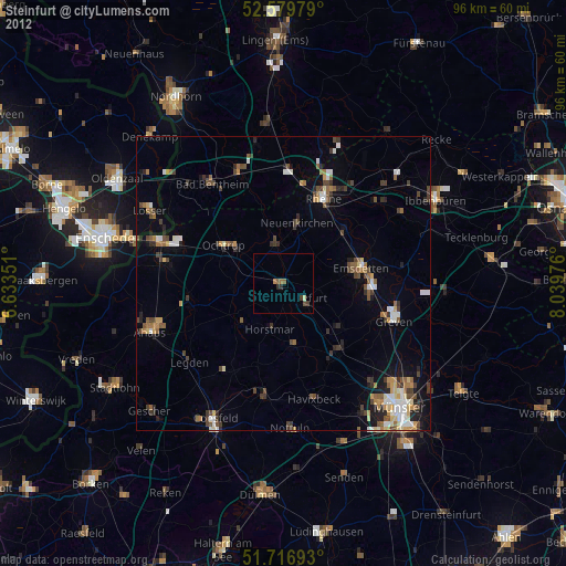
92.59%Square area 50x50 km:
0.84%90-99
1.07%80-89
0.4%70-79
0.63%60-69
1.05%50-59
1.28%40-49
1.31%30-39
1.05%20-29
1.25%10-19
3.67%0-9
87.44%Clear (daylight) street map image can be seen on geolist.org.
Map coordinates:
52° 34' 47.2" North, 6° 38' 0.6" East
52° 9' 1.6" North, 7° 20' 11.9" East
51° 43' 0.9" North, 8° 2' 23.1" East
Some cities around Steinfurt sort by population:
• Ochtrup
11.9 km =7.4 mi,  302°
302°
• Neuenkirchen
10.8 km =6.7 mi,  12°
12°
• Nordwalde
12.5 km =7.8 mi,  126°
126°
• Schöppingen
9 km =5.6 mi,  231°
231°
• Wettringen
6.7 km =4.2 mi,  349°
349°
• Horstmar
8 km =5 mi,  195°
195°
• Metelen
8.5 km =5.3 mi,  265°
265°
• Laer
10.6 km =6.6 mi,  172°
172°
2828105 (p: 34,601)
Sources (retrieved 2019-11-25):
» Earth at Night: Flat Maps 2012, 2016