Schüttorf night lights from space
Night Light of Schüttorf (Lower Saxony) from space (Germany) Src. Average luminocity for 10x10km area is 4.8914% and for 50x50km: 6.7397%.
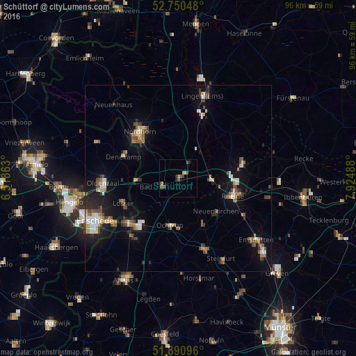
Analysis of Schüttorf night lights 2016
Square area 10x10 km:
 0.25%
0.25%90-99
0.25%80-89
0.51%70-79
0.88%60-69
0.63%50-59
0.51%40-49
3.16%30-39
0.76%20-29
1.14%10-19
0%0-9
91.92%Square area 50x50 km:
0.76%90-99
0.9%80-89
0.58%70-79
0.61%60-69
0.92%50-59
1.1%40-49
1.2%30-39
0.84%20-29
1.47%10-19
4.69%0-9
86.93%Clear (daylight) street map image can be seen on geolist.org.
Map coordinates:
52° 45' 1.7" North, 6° 31' 7.1" East
52° 19' 22.1" North, 7° 13' 18.3" East
51° 53' 27.5" North, 7° 55' 29.6" East
Some cities around Schüttorf sort by population:
• Rheine
15.5 km =9.6 mi,  105°
105°
• Nordhorn
15.9 km =9.9 mi,  319°
319°
• Ochtrup
12.9 km =8 mi,  189°
189°
• Bad Bentheim
5 km =3.1 mi,  240°
240°
• Neuenkirchen
13.4 km =8.3 mi,  130°
130°
• Emsbüren
10.1 km =6.3 mi,  31°
31°
• Wettringen
14.2 km =8.8 mi,  152°
152°
• Salzbergen
8.8 km =5.5 mi,  82°
82°
2835587 (p: 11,465)
Sources (retrieved 2019-11-25):
» Earth at Night: Flat Maps 2012, 2016