Wachtberg night lights from space
Night Light of Wachtberg (North Rhine-Westphalia) from space (Germany) Src. Average luminocity for 10x10km area is 11.9693% and for 50x50km: 15.0864%.
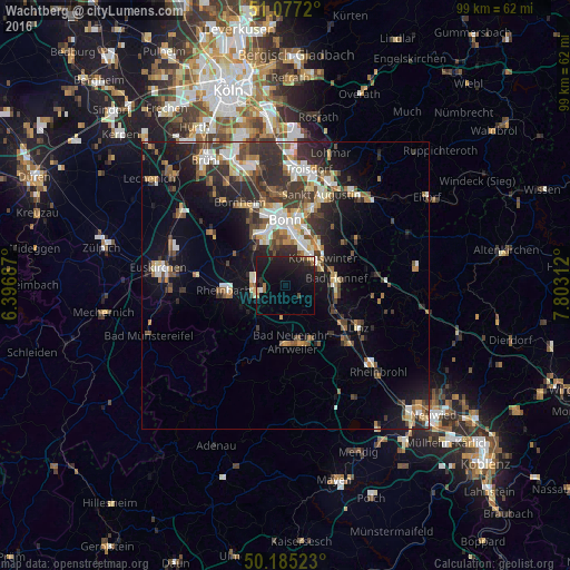
Analysis of Wachtberg night lights 2016
Square area 10x10 km:
 0.27%
0.27%90-99
0.53%80-89
0.94%70-79
0.53%60-69
1.87%50-59
0.8%40-49
0.94%30-39
1.2%20-29
7.09%10-19
26.6%0-9
59.22%Square area 50x50 km:
2.09%90-99
2.61%80-89
1.44%70-79
1.27%60-69
2.04%50-59
2.02%40-49
2.4%30-39
3.37%20-29
5.09%10-19
8.4%0-9
69.26%Clear (daylight) street map image can be seen on geolist.org.
Map coordinates:
51° 4' 37.9" North, 6° 23' 48.7" East
50° 37' 60" North, 7° 6' 0" East
50° 11' 6.8" North, 7° 48' 11.2" East
Some cities around Wachtberg sort by population:
• Bonn
11.2 km =7 mi,  358°
358°
• Königswinter
8.3 km =5.2 mi,  47°
47°
• Bad Neuenahr-Ahrweiler
10.1 km =6.3 mi,  175°
175°
• Rheinbach
10.7 km =6.6 mi,  265°
265°
• Meckenheim
5.1 km =3.2 mi,  258°
258°
• Bad Honnef
9.1 km =5.7 mi,  82°
82°
• Alfter
12.6 km =7.8 mi,  332°
332°
• Remagen
10.8 km =6.7 mi,  124°
124°
2815678 (p: 20,032)
Sources (retrieved 2019-11-25):
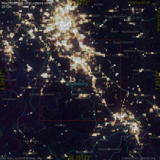
» Earth at Night: Flat Maps 2012, 2016