Königswinter night lights from space
Night Light of Königswinter (North Rhine-Westphalia) from space (Germany) Src. Average luminocity for 10x10km area is 37.0094% and for 50x50km: 16.7187%.
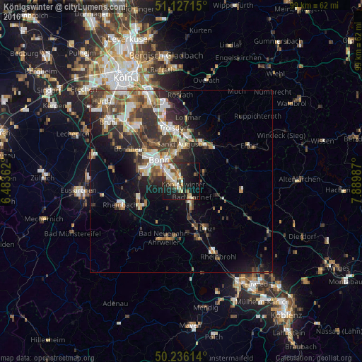
Analysis of Königswinter night lights 2016
Square area 10x10 km:
 4.55%
4.55%90-99
8.96%80-89
6.55%70-79
2.01%60-69
4.55%50-59
4.41%40-49
3.88%30-39
5.61%20-29
9.36%10-19
31.82%0-9
18.32%Square area 50x50 km:
2.64%90-99
3.07%80-89
1.64%70-79
1.3%60-69
2.29%50-59
2.5%40-49
2.65%30-39
3.82%20-29
5.28%10-19
7.51%0-9
67.3%Clear (daylight) street map image can be seen on geolist.org.
Map coordinates:
51° 7' 37.7" North, 6° 29' 1" East
50° 41' 1.5" North, 7° 11' 12.3" East
50° 14' 10.1" North, 7° 53' 23.5" East
Some cities around Königswinter sort by population:
• Bonn
8.5 km =5.3 mi,  311°
311°
• Sankt Augustin
10.2 km =6.3 mi,  4°
4°
• Hennef
12.3 km =7.6 mi,  33°
33°
• Siegburg
13 km =8.1 mi,  6°
6°
• Meckenheim
12.9 km =8 mi,  239°
239°
• Bad Honnef
5.3 km =3.3 mi,  147°
147°
• Wachtberg
8.3 km =5.2 mi,  227°
227°
• Remagen
12 km =7.5 mi,  166°
166°
2885734 (p: 41,164)
Sources (retrieved 2019-11-25):
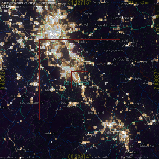
» Earth at Night: Flat Maps 2012, 2016