Bad Honnef night lights from space
Night Light of Bad Honnef (North Rhine-Westphalia) from space (Germany) Src. Average luminocity for 10x10km area is 18.3676% and for 50x50km: 14.8283%.

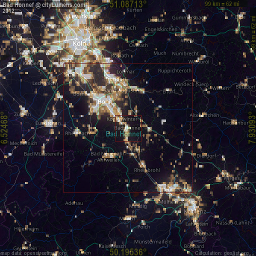
Analysis of Bad Honnef night lights 2016
Square area 10x10 km:
 1.34%
1.34%90-99
2.81%80-89
3.48%70-79
1.47%60-69
2.01%50-59
1.2%40-49
2.81%30-39
3.88%20-29
1.2%10-19
21.66%0-9
58.16%Square area 50x50 km:
2.22%90-99
2.6%80-89
1.43%70-79
1.19%60-69
2.08%50-59
2.11%40-49
2.48%30-39
3.39%20-29
5.04%10-19
7.04%0-9
70.41%Clear (daylight) street map image can be seen on geolist.org.
Map coordinates:
51° 5' 13.7" North, 6° 31' 28.8" East
50° 38' 36.1" North, 7° 13' 40.1" East
50° 11' 43.3" North, 7° 55' 51.3" East
Some cities around Bad Honnef sort by population:
• Bonn
13.8 km =8.6 mi,  317°
317°
• Königswinter
5.3 km =3.3 mi,  327°
327°
• Bad Neuenahr-Ahrweiler
13.8 km =8.6 mi,  216°
216°
• Wachtberg
9.1 km =5.7 mi,  262°
262°
• Sinzig
11.1 km =6.9 mi,  173°
173°
• Remagen
7.2 km =4.5 mi,  180°
180°
• Asbach
13.6 km =8.5 mi,  78°
78°
• Linz am Rhein
9.2 km =5.7 mi,  154°
154°
2953435 (p: 25,348)
Sources (retrieved 2019-11-25):
» Earth at Night: Flat Maps 2012, 2016