Taunusstein night lights from space
Night Light of Taunusstein (Hesse) from space (Germany) Src. Average luminocity for 10x10km area is 5.9332% and for 50x50km: 14.4653%.
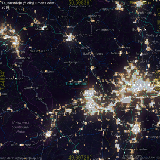
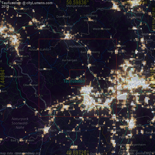
Analysis of Taunusstein night lights 2016
Square area 10x10 km:
 0%
0%90-99
0%80-89
0.67%70-79
0.67%60-69
0.53%50-59
1.07%40-49
0.53%30-39
1.07%20-29
2.54%10-19
9.09%0-9
83.82%Square area 50x50 km:
2.66%90-99
2.93%80-89
1.2%70-79
1.32%60-69
1.26%50-59
1.5%40-49
1.97%30-39
2.68%20-29
5.48%10-19
9.81%0-9
69.19%Clear (daylight) street map image can be seen on geolist.org.
Map coordinates:
50° 35' 54.1" North, 7° 26' 56.2" East
50° 8' 59.7" North, 8° 9' 7.4" East
49° 41' 50.1" North, 8° 51' 18.7" East
Some cities around Taunusstein sort by population:
• Wiesbaden
10.2 km =6.3 mi,  137°
137°
• Idstein
11.1 km =6.9 mi,  47°
47°
• Eltville
13.7 km =8.5 mi,  190°
190°
• Niedernhausen
11.6 km =7.2 mi,  82°
82°
• Bad Schwalbach
5.9 km =3.7 mi,  261°
261°
• Budenheim
14.9 km =9.3 mi,  175°
175°
• Schlangenbad
7.2 km =4.5 mi,  208°
208°
• Walluf
12.2 km =7.6 mi, 178°
2823799 (p: 29,501)
Sources (retrieved 2019-11-25):
» Earth at Night: Flat Maps 2012, 2016