Sickte night lights from space
Night Light of Sickte (Lower Saxony) from space (Germany) Src. Average luminocity for 10x10km area is 5.7235% and for 50x50km: 7.8339%.
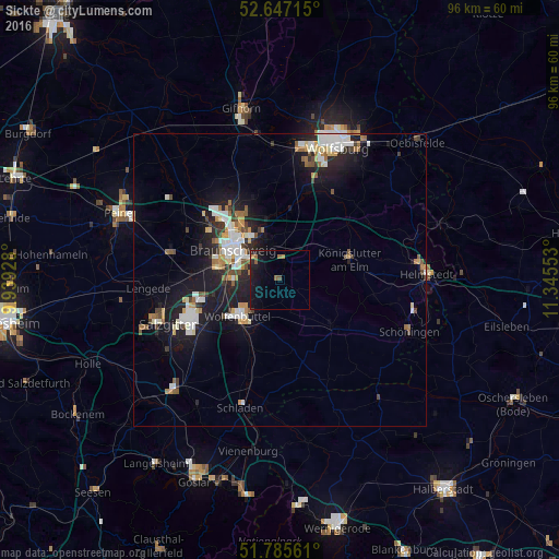
Analysis of Sickte night lights 2016
Square area 10x10 km:
 0%
0%90-99
0.26%80-89
0%70-79
1.06%60-69
1.19%50-59
1.72%40-49
0.26%30-39
0%20-29
1.59%10-19
10.58%0-9
83.33%Square area 50x50 km:
1.46%90-99
1.57%80-89
0.59%70-79
0.83%60-69
0.83%50-59
0.92%40-49
0.76%30-39
0.66%20-29
1.88%10-19
7.03%0-9
83.48%Clear (daylight) street map image can be seen on geolist.org.
Map coordinates:
52° 38' 49.7" North, 9° 56' 21.4" East
52° 13' 6.5" North, 10° 38' 32.6" East
51° 47' 8.2" North, 11° 20' 43.9" East
Some cities around Sickte sort by population:
• Braunschweig
9.5 km =5.9 mi,  303°
303°
• Salzgitter
16.9 km =10.5 mi,  246°
246°
• Wolfenbüttel
9.2 km =5.7 mi,  229°
229°
• Königslutter am Elm
12.4 km =7.7 mi,  72°
72°
• Vechelde
19.5 km =12.1 mi,  283°
283°
• Cremlingen
3.5 km =2.2 mi,  8°
8°
• Lehre
12.9 km =8 mi, 7°
• Schöppenstedt
12.3 km =7.6 mi,  132°
132°
3208620 (p: 5,755)
Sources (retrieved 2019-11-25):
» Earth at Night: Flat Maps 2012, 2016