Salzgitter night lights from space
Night Light of Salzgitter (Lower Saxony) from space (Germany) Src. Average luminocity for 10x10km area is 31.631% and for 50x50km: 6.736%.
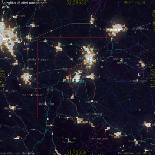
Analysis of Salzgitter night lights 2016
Square area 10x10 km:
 6.88%
6.88%90-99
8.07%80-89
3.44%70-79
2.51%60-69
0.66%50-59
1.32%40-49
1.98%30-39
1.46%20-29
5.82%10-19
50.93%0-9
16.93%Square area 50x50 km:
1.12%90-99
1.23%80-89
0.52%70-79
0.79%60-69
0.66%50-59
0.84%40-49
0.69%30-39
0.62%20-29
1.41%10-19
6.56%0-9
85.58%Clear (daylight) street map image can be seen on geolist.org.
Map coordinates:
52° 35' 10.8" North, 9° 42' 44.2" East
52° 9' 25.4" North, 10° 24' 55.4" East
51° 43' 24.9" North, 11° 7' 6.7" East
Some cities around Salzgitter sort by population:
• Braunschweig
14.3 km =8.9 mi,  32°
32°
• Wolfenbüttel
8.6 km =5.3 mi,  84°
84°
• Vechelde
12 km =7.5 mi,  343°
343°
• Lengede
9.1 km =5.7 mi,  305°
305°
• Liebenburg
15.1 km =9.4 mi,  175°
175°
• Söhlde
13 km =8.1 mi,  285°
285°
• Sickte
16.9 km =10.5 mi,  66°
66°
• Schladen
17.2 km =10.7 mi,  150°
150°
2842150 (p: 101,079)
Sources (retrieved 2019-11-25):
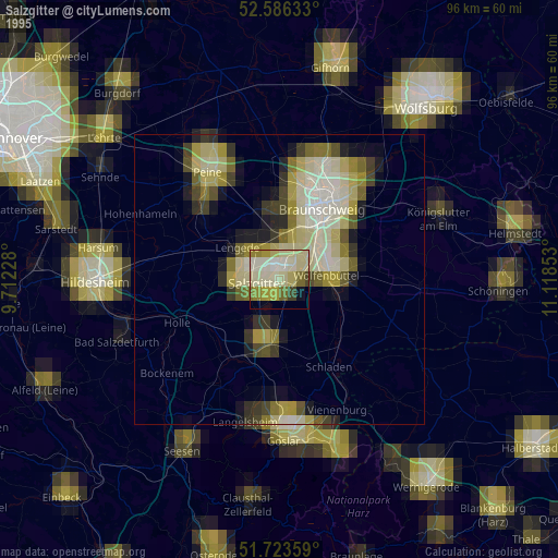
» NASA, Earths city lights 1995
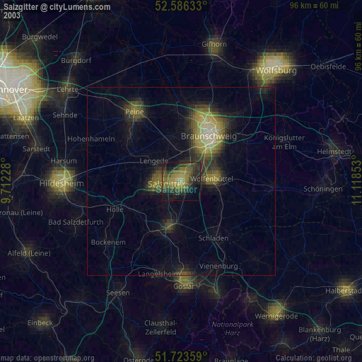
» NASA city lights 2003
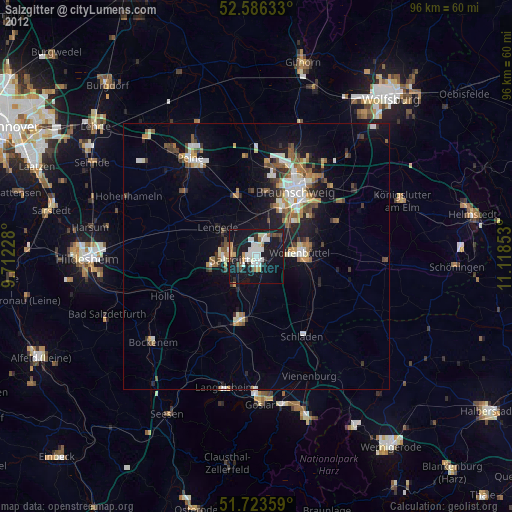
» Earth at Night: Flat Maps 2012, 2016