Wolfenbüttel night lights from space
Night Light of Wolfenbüttel (Lower Saxony) from space (Germany) Src. Average luminocity for 10x10km area is 17.5728% and for 50x50km: 6.6714%.
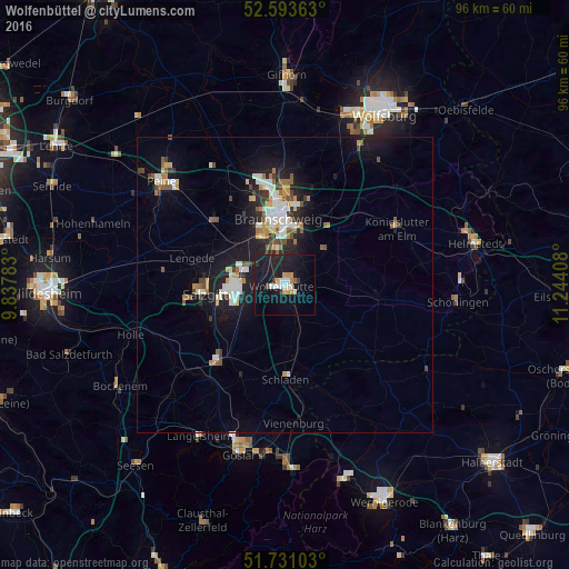

Analysis of Wolfenbüttel night lights 2016
Square area 10x10 km:
 3.17%
3.17%90-99
1.72%80-89
1.46%70-79
3.04%60-69
0.66%50-59
0.53%40-49
0.79%30-39
1.06%20-29
2.78%10-19
35.19%0-9
49.6%Square area 50x50 km:
1.07%90-99
1.22%80-89
0.52%70-79
0.76%60-69
0.63%50-59
0.85%40-49
0.69%30-39
0.62%20-29
1.41%10-19
6.72%0-9
85.51%Clear (daylight) street map image can be seen on geolist.org.
Map coordinates:
52° 35' 37.1" North, 9° 50' 16.2" East
52° 9' 51.9" North, 10° 32' 27.4" East
51° 43' 51.7" North, 11° 14' 38.7" East
Some cities around Wolfenbüttel sort by population:
• Braunschweig
11.3 km =7 mi,  355°
355°
• Salzgitter
8.6 km =5.3 mi,  264°
264°
• Vechelde
16.1 km =10 mi,  311°
311°
• Lengede
16.5 km =10.3 mi,  285°
285°
• Cremlingen
12.1 km =7.5 mi,  37°
37°
• Schöppenstedt
16.1 km =10 mi,  98°
98°
• Sickte
9.2 km =5.7 mi,  49°
49°
• Schladen
15.8 km =9.8 mi,  180°
180°
2806914 (p: 54,740)
Sources (retrieved 2019-11-25):
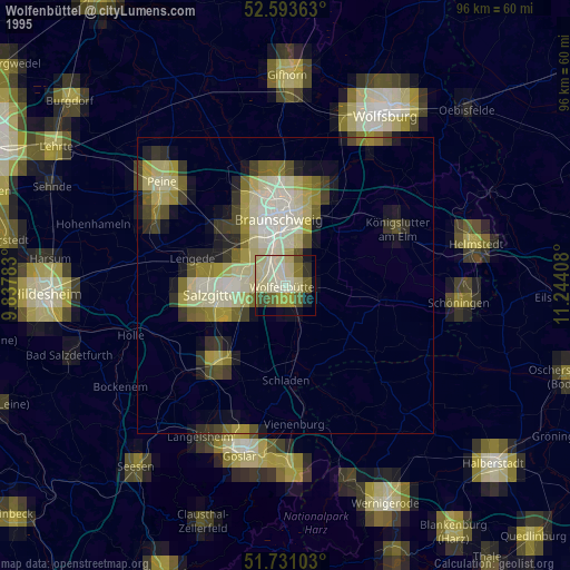
» NASA, Earths city lights 1995
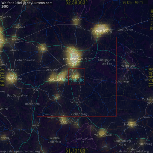
» NASA city lights 2003
» Earth at Night: Flat Maps 2012, 2016