Lehre night lights from space
Night Light of Lehre (Lower Saxony) from space (Germany) Src. Average luminocity for 10x10km area is 2.9684% and for 50x50km: 8.5255%.
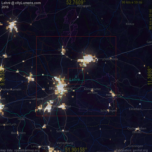
Analysis of Lehre night lights 2016
Square area 10x10 km:
 0%
0%90-99
0%80-89
0.25%70-79
0.25%60-69
0.51%50-59
0.51%40-49
0.51%30-39
0.25%20-29
0%10-19
4.42%0-9
93.31%Square area 50x50 km:
1.54%90-99
1.64%80-89
0.7%70-79
0.94%60-69
0.89%50-59
0.92%40-49
0.88%30-39
0.68%20-29
2.23%10-19
8.12%0-9
81.47%Clear (daylight) street map image can be seen on geolist.org.
Map coordinates:
52° 45' 39.2" North, 9° 57' 48.8" East
52° 19' 60" North, 10° 40' 0" East
51° 54' 5.7" North, 11° 22' 11.3" East
Some cities around Lehre sort by population:
• Braunschweig
12.1 km =7.5 mi,  231°
231°
• Wolfsburg
12.8 km =8 mi,  37°
37°
• Königslutter am Elm
13.7 km =8.5 mi,  131°
131°
• Cremlingen
9.3 km =5.8 mi,  186°
186°
• Westhagen
9.3 km =5.8 mi,  32°
32°
• Detmerode
8.3 km =5.2 mi, 40°
• Isenbüttel
12.5 km =7.8 mi,  333°
333°
• Sickte
12.9 km =8 mi, 187°
2879378 (p: 11,777)
Sources (retrieved 2019-11-25):
» Earth at Night: Flat Maps 2012, 2016