Senden night lights from space
Night Light of Senden (Bavaria) from space (Germany) Src. Average luminocity for 10x10km area is 14.6293% and for 50x50km: 7.065%.
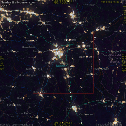
Analysis of Senden night lights 2016
Square area 10x10 km:
 0%
0%90-99
0.85%80-89
1.99%70-79
1.7%60-69
1.14%50-59
0.14%40-49
2.98%30-39
3.27%20-29
7.24%10-19
21.16%0-9
59.52%Square area 50x50 km:
0.89%90-99
1.05%80-89
0.55%70-79
0.83%60-69
0.82%50-59
0.82%40-49
1.35%30-39
1.18%20-29
1.67%10-19
4.07%0-9
86.77%Clear (daylight) street map image can be seen on geolist.org.
Map coordinates:
48° 47' 23.2" North, 9° 20' 28.7" East
48° 19' 27.9" North, 10° 2' 39.9" East
47° 51' 17.1" North, 10° 44' 51.2" East
Some cities around Senden sort by population:
• Ulm
9.1 km =5.7 mi,  334°
334°
• Neu-Ulm
8 km =5 mi,  342°
342°
• Illertissen
12.1 km =7.5 mi,  158°
158°
• Weißenhorn
8.8 km =5.5 mi,  104°
104°
• Erbach
11.6 km =7.2 mi,  272°
272°
• Vöhringen
5.8 km =3.6 mi,  151°
151°
• Pfaffenhofen an der Roth
9.3 km =5.8 mi,  68°
68°
• Dietenheim
12.8 km =8 mi,  170°
170°
2833080 (p: 22,275)
Sources (retrieved 2019-11-25):
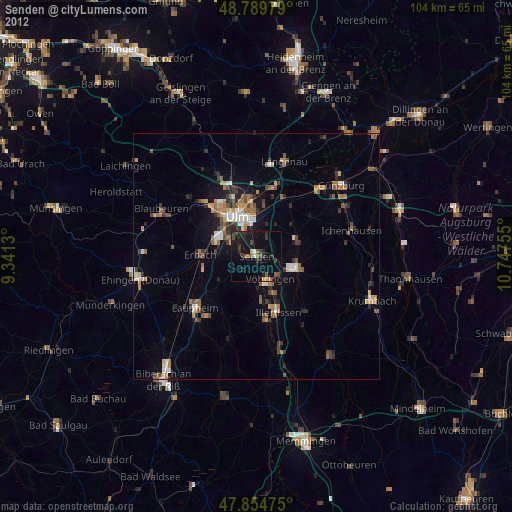
» Earth at Night: Flat Maps 2012, 2016