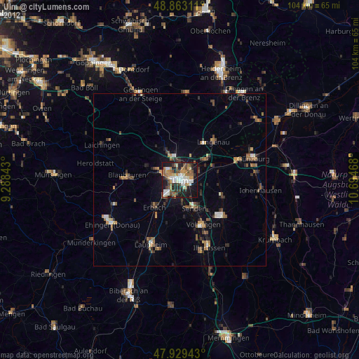
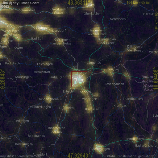
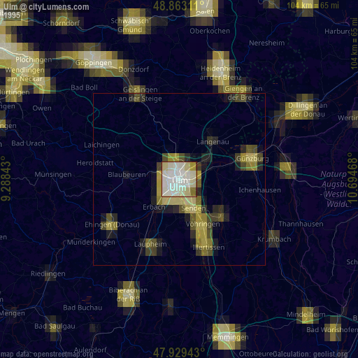
Ulm night lights from space
Night Light of Ulm (Baden-Württemberg) from space (Germany) Src. Average luminocity for 10x10km area is 53.8849% and for 50x50km: 7.1099%.
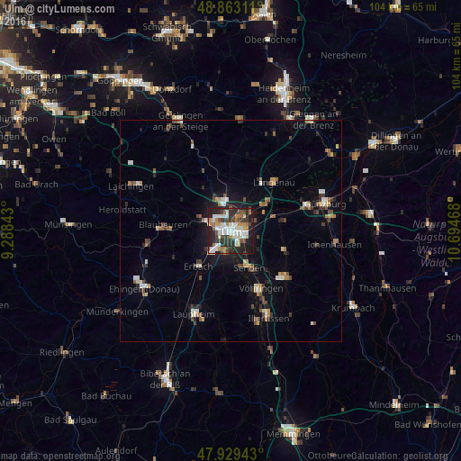
Analysis of Ulm night lights 2016
Square area 10x10 km:
 13.35%
90-99
12.22%80-89
3.41%70-79
7.1%60-69
7.1%50-59
3.69%40-49
6.82%30-39
9.94%20-29
21.02%10-19
15.2%0-9
0.14%Square area 50x50 km:
0.87%90-99
1.04%80-89
0.58%70-79
0.91%60-69
0.68%50-59
0.86%40-49
1.26%30-39
1.2%20-29
1.72%10-19
4.14%0-9
86.75%Clear (daylight) street map image can be seen on geolist.org.
Map coordinates:
48° 51' 47.2" North, 9° 17' 18.3" East
48° 23' 54.3" North, 9° 59' 29.6" East
47° 55' 45.9" North, 10° 41' 40.8" East
Some cities around Ulm sort by population:
• Neu-Ulm
1.6 km =1 mi,  113°
113°
• Senden
9.1 km =5.7 mi,  154°
154°
• Klingenstein
6.6 km =4.1 mi,  289°
289°
• Langenau
14.3 km =8.9 mi,  40°
40°
• Erbach
10.9 km =6.8 mi,  224°
224°
• Nersingen
10.3 km =6.4 mi,  71°
71°
• Dornstadt
8.4 km =5.2 mi,  335°
335°
• Pfaffenhofen an der Roth
13.5 km =8.4 mi, 111°
2820256 (p: 120,451)
Sources (retrieved 2019-11-25):
» NASA, Earths city lights 1995
» NASA city lights 2003
» Earth at Night: Flat Maps 2012, 2016