Vöhringen night lights from space
Night Light of Vöhringen (Bavaria) from space (Germany) Src. Average luminocity for 10x10km area is 14.6131% and for 50x50km: 7.0276%.
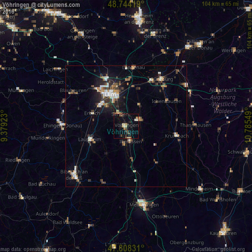
Analysis of Vöhringen night lights 2016
Square area 10x10 km:
 0.45%
0.45%90-99
1.93%80-89
2.68%70-79
1.49%60-69
0.89%50-59
0.3%40-49
3.13%30-39
3.13%20-29
2.38%10-19
7.59%0-9
76.04%Square area 50x50 km:
0.89%90-99
1.06%80-89
0.52%70-79
0.8%60-69
0.84%50-59
0.78%40-49
1.41%30-39
1.2%20-29
1.53%10-19
4.07%0-9
86.88%Clear (daylight) street map image can be seen on geolist.org.
Map coordinates:
48° 44' 39.1" North, 9° 22' 45.2" East
48° 16' 42.2" North, 10° 4' 56.5" East
47° 48' 29.9" North, 10° 47' 7.8" East
Some cities around Vöhringen sort by population:
• Ulm
14.9 km =9.3 mi,  333°
333°
• Neu-Ulm
13.8 km =8.6 mi,  337°
337°
• Senden
5.8 km =3.6 mi, 331°
• Illertissen
6.3 km =3.9 mi,  165°
165°
• Weißenhorn
6.5 km =4 mi,  62°
62°
• Pfaffenhofen an der Roth
10.3 km =6.4 mi,  34°
34°
• Dietenheim
7.6 km =4.7 mi,  186°
186°
• Schwendi
14 km =8.7 mi,  214°
214°
2816761 (p: 13,207)
Sources (retrieved 2019-11-25):
» Earth at Night: Flat Maps 2012, 2016