Schönenberg-Kübelberg night lights from space
Night Light of Schönenberg-Kübelberg (Rheinland-Pfalz) from space (Germany) Src. Average luminocity for 10x10km area is 9.7366% and for 50x50km: 10.5727%.
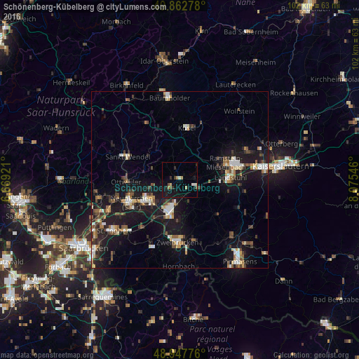
Analysis of Schönenberg-Kübelberg night lights 2016
Square area 10x10 km:
 0.27%
0.27%90-99
1.6%80-89
1.34%70-79
0%60-69
1.6%50-59
1.2%40-49
0.94%30-39
1.2%20-29
2.27%10-19
12.17%0-9
77.41%Square area 50x50 km:
1.22%90-99
1.57%80-89
1.05%70-79
0.9%60-69
1.13%50-59
1.33%40-49
1.77%30-39
1.62%20-29
2.63%10-19
12.43%0-9
74.35%Clear (daylight) street map image can be seen on geolist.org.
Map coordinates:
49° 51' 46" North, 6° 40' 9.2" East
49° 24' 26.6" North, 7° 22' 20.4" East
48° 56' 51.9" North, 8° 4' 31.7" East
Some cities around Schönenberg-Kübelberg sort by population:
• Homburg
9.3 km =5.8 mi,  195°
195°
• Bexbach
10.9 km =6.8 mi,  231°
231°
• Ottweiler
15.1 km =9.4 mi,  267°
267°
• Landstuhl
14.3 km =8.9 mi,  87°
87°
• Ramstein-Miesenbach
13.9 km =8.6 mi,  72°
72°
• Bruchmühlbach-Miesau
5.2 km =3.2 mi,  121°
121°
• Waldmohr
3.9 km =2.4 mi, 226°
• Kusel
14.7 km =9.1 mi,  9°
9°
3207540 (p: 5,957)
Sources (retrieved 2019-11-25):
» Earth at Night: Flat Maps 2012, 2016