Homburg night lights from space
Night Light of Homburg (Saarland) from space (Germany) Src. Average luminocity for 10x10km area is 25.3904% and for 50x50km: 11.9743%.
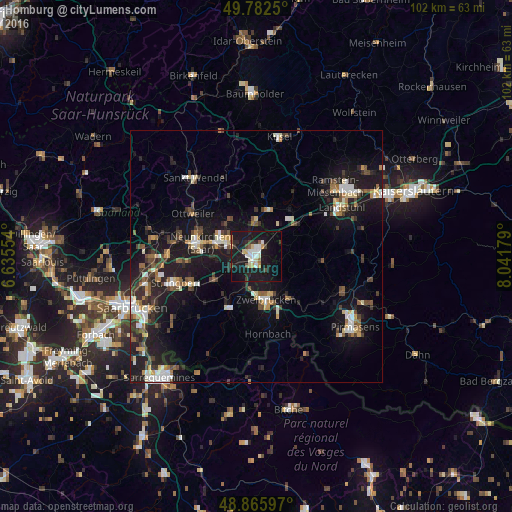
Analysis of Homburg night lights 2016
Square area 10x10 km:
 3.48%
3.48%90-99
4.28%80-89
3.48%70-79
2.01%60-69
0.67%50-59
2.01%40-49
3.07%30-39
1.74%20-29
6.42%10-19
48.26%0-9
24.6%Square area 50x50 km:
1.45%90-99
1.8%80-89
1.12%70-79
1.11%60-69
1.19%50-59
1.41%40-49
1.95%30-39
1.96%20-29
3.44%10-19
13.91%0-9
70.65%Clear (daylight) street map image can be seen on geolist.org.
Map coordinates:
49° 46' 57" North, 6° 38' 7.9" East
49° 19' 34.9" North, 7° 20' 19.2" East
48° 51' 57.5" North, 8° 2' 30.4" East
Some cities around Homburg sort by population:
• Zweibrücken
9.1 km =5.7 mi,  165°
165°
• Blieskastel
11.6 km =7.2 mi,  211°
211°
• Bexbach
6.4 km =4 mi,  290°
290°
• Kirkel
9 km =5.6 mi,  237°
237°
• Bruchmühlbach-Miesau
9.3 km =5.8 mi,  47°
47°
• Schönenberg-Kübelberg
9.3 km =5.8 mi,  15°
15°
• Waldmohr
6.3 km =3.9 mi,  356°
356°
• Contwig
10.9 km =6.8 mi,  141°
141°
2899449 (p: 44,607)
Sources (retrieved 2019-11-25):
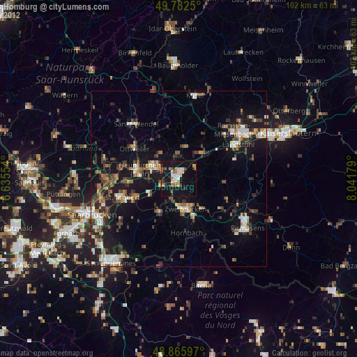
» Earth at Night: Flat Maps 2012, 2016