Ramstein-Miesenbach night lights from space
Night Light of Ramstein-Miesenbach (Rheinland-Pfalz) from space (Germany) Src. Average luminocity for 10x10km area is 29.7983% and for 50x50km: 8.0928%.
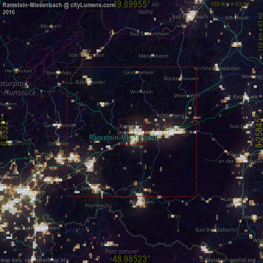
Analysis of Ramstein-Miesenbach night lights 2016
Square area 10x10 km:
 4.76%
4.76%90-99
5.88%80-89
4.2%70-79
2.24%60-69
4.9%50-59
2.1%40-49
3.08%30-39
3.64%20-29
8.54%10-19
27.87%0-9
32.77%Square area 50x50 km:
1%90-99
1.28%80-89
0.97%70-79
0.69%60-69
0.72%50-59
0.72%40-49
1.26%30-39
0.95%20-29
1.66%10-19
9.84%0-9
80.92%Clear (daylight) street map image can be seen on geolist.org.
Map coordinates:
49° 53' 58.4" North, 6° 51' 7.9" East
49° 26' 40.3" North, 7° 33' 19.2" East
48° 59' 6.8" North, 8° 15' 30.4" East
Some cities around Ramstein-Miesenbach sort by population:
• Kaiserslautern
15.6 km =9.7 mi,  90°
90°
• Landstuhl
3.7 km =2.3 mi,  162°
162°
• Bruchmühlbach-Miesau
11.1 km =6.9 mi,  232°
232°
• Schönenberg-Kübelberg
13.9 km =8.6 mi,  252°
252°
• Waldmohr
17.4 km =10.8 mi, 247°
• Otterberg
16.8 km =10.4 mi,  67°
67°
• Kusel
15 km =9.3 mi,  313°
313°
• Waldfischbach-Burgalben
19.7 km =12.2 mi, 155°
2850536 (p: 8,078)
Sources (retrieved 2019-11-25):
» Earth at Night: Flat Maps 2012, 2016