Schmallenberg night lights from space
Night Light of Schmallenberg (North Rhine-Westphalia) from space (Germany) Src. Average luminocity for 10x10km area is 0.3971% and for 50x50km: 0.8297%.
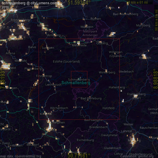
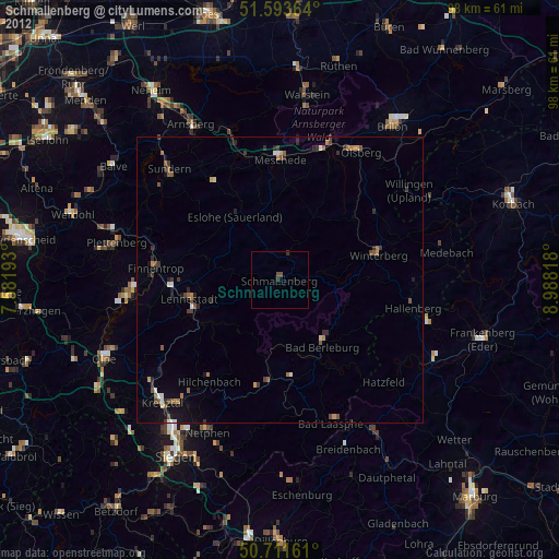
Analysis of Schmallenberg night lights 2016
Square area 10x10 km:
 0%
0%90-99
0%80-89
0%70-79
0%60-69
0%50-59
0%40-49
0%30-39
0.8%20-29
0.27%10-19
0%0-9
98.93%Square area 50x50 km:
0.03%90-99
0.07%80-89
0.02%70-79
0.07%60-69
0.07%50-59
0.19%40-49
0.41%30-39
0.26%20-29
0.17%10-19
0.23%0-9
98.49%Clear (daylight) street map image can be seen on geolist.org.
Map coordinates:
51° 35' 37.1" North, 7° 34' 54.9" East
51° 9' 17" North, 8° 17' 6.2" East
50° 42' 41.8" North, 8° 59' 17.4" East
Some cities around Schmallenberg sort by population:
• Meschede
21.7 km =13.5 mi,  359°
359°
• Lennestadt
15.8 km =9.8 mi,  254°
254°
• Bad Berleburg
13.6 km =8.5 mi,  146°
146°
• Hilchenbach
21.4 km =13.3 mi,  214°
214°
• Winterberg
17.9 km =11.1 mi,  76°
76°
• Kirchhundem
15.7 km =9.8 mi,  240°
240°
• Eslohe
13.6 km =8.5 mi,  323°
323°
• Erndtebrück
18.5 km =11.5 mi,  186°
186°
2838053 (p: 26,132)
Sources (retrieved 2019-11-25):
» Earth at Night: Flat Maps 2012, 2016