Raubling night lights from space
Night Light of Raubling (Bavaria) from space (Germany) Src. Average luminocity for 10x10km area is 6.6057% and for 50x50km: 2.3222%.
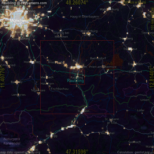
Analysis of Raubling night lights 2016
Square area 10x10 km:
 0%
0%90-99
0%80-89
0%70-79
0.45%60-69
0.15%50-59
1.34%40-49
1.64%30-39
1.79%20-29
1.64%10-19
13.1%0-9
79.91%Square area 50x50 km:
0.23%90-99
0.28%80-89
0.14%70-79
0.36%60-69
0.31%50-59
0.32%40-49
0.42%30-39
0.47%20-29
0.38%10-19
1.55%0-9
95.55%Clear (daylight) street map image can be seen on geolist.org.
Map coordinates:
48° 15' 38.7" North, 11° 24' 27.9" East
47° 47' 25.8" North, 12° 6' 39.2" East
47° 18' 57.5" North, 12° 48' 50.4" East
Some cities around Raubling sort by population:
• Rosenheim
7.4 km =4.6 mi,  6°
6°
• Kolbermoor
7.3 km =4.5 mi,  333°
333°
• Stephanskirchen
9 km =5.6 mi,  38°
38°
• Bad Feilnbach
7.8 km =4.8 mi,  255°
255°
• Brannenburg
5.8 km =3.6 mi,  194°
194°
• Rohrdorf
4.5 km =2.8 mi,  80°
80°
• Riedering
9 km =5.6 mi,  53°
53°
• Burg Unter-Falkenstein
9.6 km =6 mi,  182°
182°
2850085 (p: 11,382)
Sources (retrieved 2019-11-25):
» Earth at Night: Flat Maps 2012, 2016