Bad Feilnbach night lights from space
Night Light of Bad Feilnbach (Bavaria) from space (Germany) Src. Average luminocity for 10x10km area is 0.3676% and for 50x50km: 2.6509%.
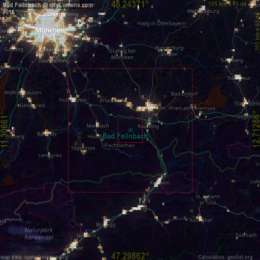
Analysis of Bad Feilnbach night lights 2016
Square area 10x10 km:
 0%
0%90-99
0%80-89
0%70-79
0%60-69
0%50-59
0%40-49
0%30-39
0%20-29
0%10-19
0%0-9
100%Square area 50x50 km:
0.29%90-99
0.32%80-89
0.14%70-79
0.4%60-69
0.36%50-59
0.29%40-49
0.53%30-39
0.52%20-29
0.49%10-19
1.65%0-9
95.02%Clear (daylight) street map image can be seen on geolist.org.
Map coordinates:
48° 14' 37.4" North, 11° 18' 23.8" East
47° 46' 23.9" North, 12° 0' 35" East
47° 17' 55" North, 12° 42' 46.3" East
Some cities around Bad Feilnbach sort by population:
• Kolbermoor
9.5 km =5.9 mi,  26°
26°
• Bad Aibling
10.1 km =6.3 mi,  0°
0°
• Raubling
7.8 km =4.8 mi,  75°
75°
• Schliersee
12 km =7.5 mi,  249°
249°
• Brannenburg
7.2 km =4.5 mi,  121°
121°
• Fischbachau
7.4 km =4.6 mi,  216°
216°
• Rohrdorf
12.3 km =7.6 mi, 77°
• Burg Unter-Falkenstein
10.4 km =6.5 mi,  137°
137°
2953460 (p: 7,203)
Sources (retrieved 2019-11-25):
» Earth at Night: Flat Maps 2012, 2016