Burg Unter-Falkenstein night lights from space
Night Light of Burg Unter-Falkenstein (Bavaria) from space (Germany) Src. Average luminocity for 10x10km area is 0.3452% and for 50x50km: 2.9492%.
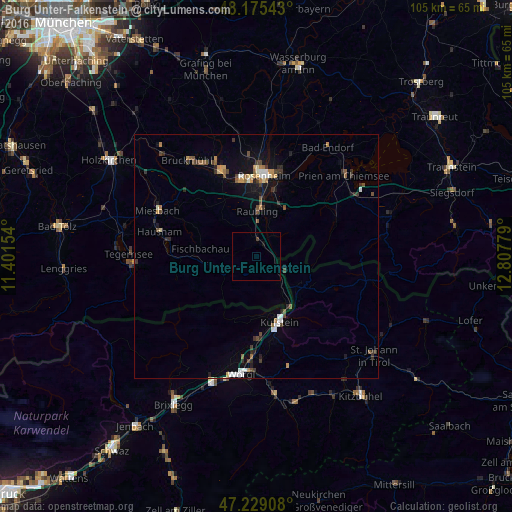
Analysis of Burg Unter-Falkenstein night lights 2016
Square area 10x10 km:
 0%
0%90-99
0%80-89
0%70-79
0%60-69
0%50-59
0%40-49
0%30-39
0.6%20-29
0%10-19
0.45%0-9
98.96%Square area 50x50 km:
0.35%90-99
0.36%80-89
0.16%70-79
0.41%60-69
0.34%50-59
0.37%40-49
0.51%30-39
0.67%20-29
0.51%10-19
1.62%0-9
94.7%Clear (daylight) street map image can be seen on geolist.org.
Map coordinates:
48° 10' 31.5" North, 11° 24' 5.5" East
47° 42' 15.8" North, 12° 6' 16.8" East
47° 13' 44.7" North, 12° 48' 28" East
Some cities around Burg Unter-Falkenstein sort by population:
• Kolbermoor
16.4 km =10.2 mi,  350°
350°
• Raubling
9.6 km =6 mi,  2°
2°
• Kufstein, AT
14.2 km =8.8 mi,  160°
160°
• Bad Feilnbach
10.4 km =6.5 mi,  317°
317°
• Kiefersfelden
11.9 km =7.4 mi,  147°
147°
• Brannenburg
4.1 km =2.5 mi, 346°
• Fischbachau
11.6 km =7.2 mi,  278°
278°
• Rohrdorf
11.4 km =7.1 mi,  25°
25°
8378906 (p: 0)
Sources (retrieved 2019-11-25):
» Earth at Night: Flat Maps 2012, 2016