Rath night lights from space
Night Light of Rath (North Rhine-Westphalia) from space (Germany) Src. Average luminocity for 10x10km area is 49.3039% and for 50x50km: 30.1664%.
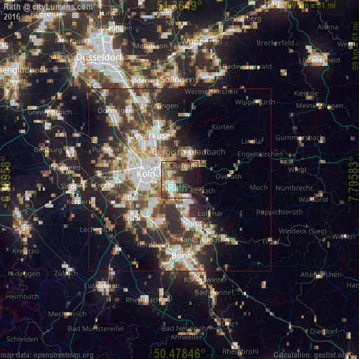
Analysis of Rath night lights 2016
Square area 10x10 km:
 6.3%
6.3%90-99
7.28%80-89
6.16%70-79
5.74%60-69
13.31%50-59
7.42%40-49
4.9%30-39
13.45%20-29
18.91%10-19
16.53%0-9
0%Square area 50x50 km:
5.78%90-99
6.13%80-89
2.86%70-79
3%60-69
4.11%50-59
4.42%40-49
4.46%30-39
6.88%20-29
8.37%10-19
10.92%0-9
43.07%Clear (daylight) street map image can be seen on geolist.org.
Map coordinates:
51° 21' 53.6" North, 6° 23' 22.5" East
50° 55' 25.6" North, 7° 5' 33.7" East
50° 28' 42.5" North, 7° 47' 45" East
Some cities around Rath sort by population:
• Kalk
6.3 km =3.9 mi,  286°
286°
• Humboldtkolonie
6.9 km =4.3 mi,  277°
277°
• Porz am Rhein
4.8 km =3 mi,  210°
210°
• Buchheim
5.9 km =3.7 mi,  301°
301°
• Höhenberg
3.7 km =2.3 mi, 286°
• Ostheim
3.5 km =2.2 mi, 283°
• Eil
3.5 km =2.2 mi,  195°
195°
• Buchforst
6.8 km =4.2 mi, 296°
2850224 (p: 11,000)
Sources (retrieved 2019-11-25):
» Earth at Night: Flat Maps 2012, 2016