Eil night lights from space
Night Light of Eil (North Rhine-Westphalia) from space (Germany) Src. Average luminocity for 10x10km area is 56.535% and for 50x50km: 29.6846%.
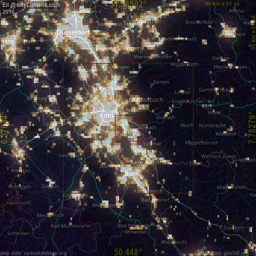
Analysis of Eil night lights 2016
Square area 10x10 km:
 11.06%
90-99
10.36%80-89
5.32%70-79
4.62%60-69
13.31%50-59
11.76%40-49
5.74%30-39
15.69%20-29
14.71%10-19
7.42%0-9
0%Square area 50x50 km:
5.72%90-99
6.07%80-89
2.83%70-79
2.95%60-69
4.09%50-59
4.3%40-49
4.23%30-39
6.36%20-29
8.07%10-19
11.45%0-9
43.93%Clear (daylight) street map image can be seen on geolist.org.
Map coordinates:
51° 20' 6.1" North, 6° 22' 35.5" East
50° 53' 37" North, 7° 4' 46.8" East
50° 26' 52.8" North, 7° 46' 58" East
Some cities around Eil sort by population:
• Rösrath
7.2 km =4.5 mi,  88°
88°
• Humboldtkolonie
7.3 km =4.5 mi,  305°
305°
• Porz am Rhein
1.7 km =1.1 mi,  241°
241°
• Höhenberg
5.2 km =3.2 mi,  328°
328°
• Ostheim
4.9 km =3 mi, 329°
• Poll
6.6 km =4.1 mi,  288°
288°
• Rath
3.5 km =2.2 mi,  15°
15°
• Wahn-Heide
4.3 km =2.7 mi,  153°
153°
2931881 (p: 8,849)
Sources (retrieved 2019-11-25):
» Earth at Night: Flat Maps 2012, 2016