Höhenberg night lights from space
Night Light of Höhenberg (North Rhine-Westphalia) from space (Germany) Src. Average luminocity for 10x10km area is 69.3473% and for 50x50km: 31.2649%.
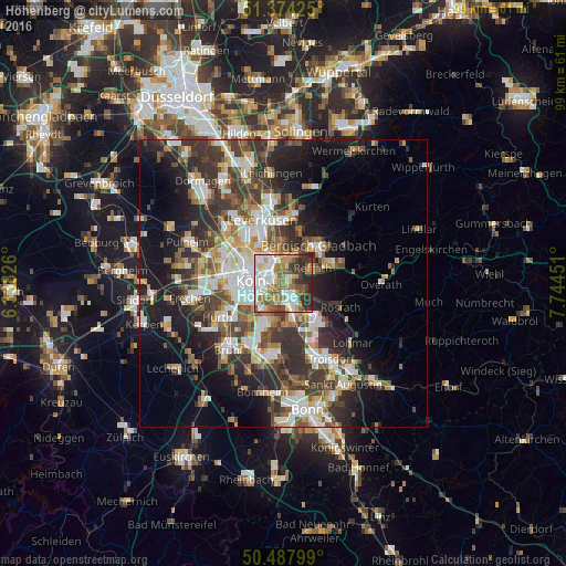
Analysis of Höhenberg night lights 2016
Square area 10x10 km:
 18.21%
90-99
16.81%80-89
6.58%70-79
7.28%60-69
15.83%50-59
9.24%40-49
5.04%30-39
12.04%20-29
8.96%10-19
0%0-9
0%Square area 50x50 km:
5.9%90-99
6.24%80-89
2.96%70-79
3.1%60-69
4.12%50-59
4.61%40-49
4.57%30-39
7.13%20-29
8.77%10-19
12.9%0-9
39.69%Clear (daylight) street map image can be seen on geolist.org.
Map coordinates:
51° 22' 27.3" North, 6° 20' 17.7" East
50° 55' 59.6" North, 7° 2' 29" East
50° 29' 16.8" North, 7° 44' 40.2" East
Some cities around Höhenberg sort by population:
• Mülheim
4.5 km =2.8 mi,  324°
324°
• Kalk
2.6 km =1.6 mi,  287°
287°
• Humboldtkolonie
3.3 km =2.1 mi,  267°
267°
• Buchheim
2.5 km =1.6 mi, 324°
• Ostheim
0.3 km =0.2 mi,  140°
140°
• Poll
4.2 km =2.6 mi,  237°
237°
• Rath
3.7 km =2.3 mi,  106°
106°
• Buchforst
3.2 km =2 mi,  308°
308°
2901908 (p: 12,133)
Sources (retrieved 2019-11-25):
» Earth at Night: Flat Maps 2012, 2016