Petersaurach night lights from space
Night Light of Petersaurach (Bavaria) from space (Germany) Src. Average luminocity for 10x10km area is 3.631% and for 50x50km: 7.9113%.
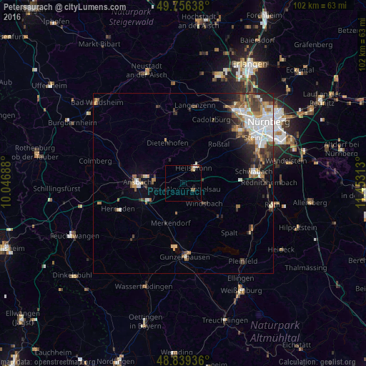
Analysis of Petersaurach night lights 2016
Square area 10x10 km:
 0.53%
0.53%90-99
0.53%80-89
0.53%70-79
0%60-69
0.53%50-59
1.6%40-49
0.53%30-39
0%20-29
0.53%10-19
0.53%0-9
94.65%Square area 50x50 km:
1.91%90-99
1.37%80-89
0.59%70-79
0.71%60-69
1.03%50-59
1.24%40-49
1.25%30-39
1.28%20-29
1.58%10-19
2.67%0-9
86.37%Clear (daylight) street map image can be seen on geolist.org.
Map coordinates:
49° 45' 23" North, 10° 2' 48.8" East
49° 18' 0" North, 10° 45' 0" East
48° 50' 21.7" North, 11° 27' 11.3" East
Some cities around Petersaurach sort by population:
• Ansbach
11.4 km =7.1 mi,  272°
272°
• Roßtal
14.6 km =9.1 mi,  43°
43°
• Heilsbronn
4.8 km =3 mi,  34°
34°
• Neuendettelsau
3 km =1.9 mi,  127°
127°
• Windsbach
8 km =5 mi,  136°
136°
• Dietenhofen
11.9 km =7.4 mi,  338°
338°
• Abenberg
16.8 km =10.4 mi,  112°
112°
• Spalt
18.8 km =11.7 mi, 137°
2854737 (p: 5,116)
Sources (retrieved 2019-11-25):
» Earth at Night: Flat Maps 2012, 2016