Spalt night lights from space
Night Light of Spalt (Bavaria) from space (Germany) Src. Average luminocity for 10x10km area is 0.2619% and for 50x50km: 4.0977%.
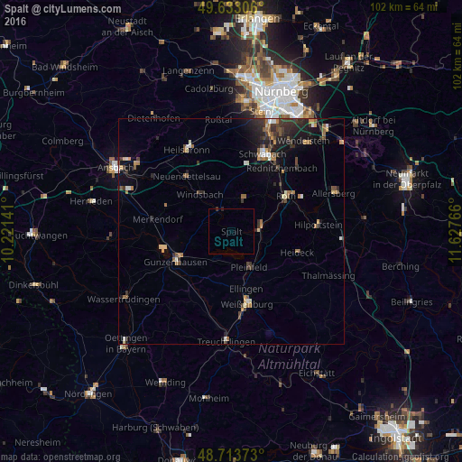
Analysis of Spalt night lights 2016
Square area 10x10 km:
 0%
0%90-99
0%80-89
0%70-79
0%60-69
0%50-59
0%40-49
0%30-39
0.28%20-29
0.28%10-19
0%0-9
99.44%Square area 50x50 km:
0.32%90-99
0.44%80-89
0.37%70-79
0.4%60-69
0.69%50-59
0.71%40-49
0.63%30-39
0.95%20-29
1.48%10-19
2.47%0-9
91.54%Clear (daylight) street map image can be seen on geolist.org.
Map coordinates:
49° 37' 59" North, 10° 13' 17.1" East
49° 10' 31.9" North, 10° 55' 28.3" East
48° 42' 49.4" North, 11° 37' 39.6" East
Some cities around Spalt sort by population:
• Roth
14.5 km =9 mi,  56°
56°
• Gunzenhausen
13.7 km =8.5 mi,  241°
241°
• Pleinfeld
8.9 km =5.5 mi,  152°
152°
• Georgensgmünd
6.9 km =4.3 mi,  76°
76°
• Windsbach
10.7 km =6.6 mi,  318°
318°
• Abenberg
8 km =5 mi,  20°
20°
• Büchenbach
14.2 km =8.8 mi,  43°
43°
• Heideck
15.5 km =9.6 mi,  107°
107°
2830849 (p: 5,216)
Sources (retrieved 2019-11-25):
» Earth at Night: Flat Maps 2012, 2016