Windsbach night lights from space
Night Light of Windsbach (Bavaria) from space (Germany) Src. Average luminocity for 10x10km area is 1.492% and for 50x50km: 8.0784%.
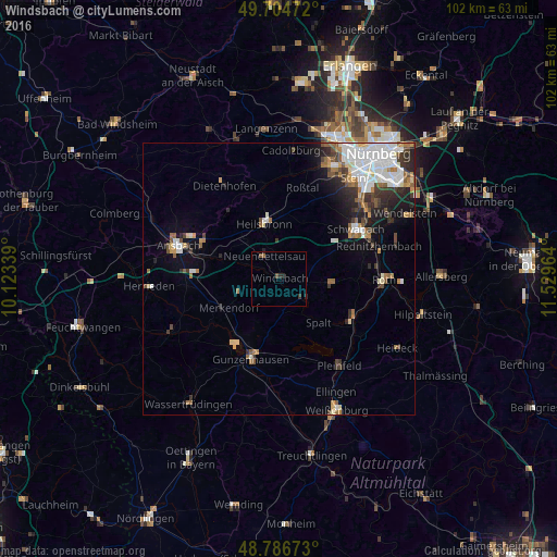
Analysis of Windsbach night lights 2016
Square area 10x10 km:
 0%
0%90-99
0%80-89
0%70-79
0%60-69
0%50-59
0.94%40-49
0.67%30-39
0.53%20-29
1.34%10-19
0.27%0-9
96.26%Square area 50x50 km:
2.14%90-99
1.55%80-89
0.56%70-79
0.61%60-69
1.04%50-59
1.04%40-49
0.91%30-39
1.24%20-29
1.78%10-19
2.81%0-9
86.32%Clear (daylight) street map image can be seen on geolist.org.
Map coordinates:
49° 42' 17" North, 10° 7' 24.2" East
49° 14' 52.3" North, 10° 49' 35.4" East
48° 47' 12.2" North, 11° 31' 46.7" East
Some cities around Windsbach sort by population:
• Gunzenhausen
15.4 km =9.6 mi,  198°
198°
• Roßtal
17 km =10.6 mi,  15°
15°
• Heilsbronn
10.2 km =6.3 mi,  343°
343°
• Neuendettelsau
5 km =3.1 mi,  321°
321°
• Georgensgmünd
15.2 km =9.4 mi,  115°
115°
• Abenberg
10 km =6.2 mi,  93°
93°
• Spalt
10.7 km =6.6 mi,  138°
138°
• Petersaurach
8 km =5 mi, 316°
2808101 (p: 6,235)
Sources (retrieved 2019-11-25):
» Earth at Night: Flat Maps 2012, 2016