Abenberg night lights from space
Night Light of Abenberg (Bavaria) from space (Germany) Src. Average luminocity for 10x10km area is 1.7112% and for 50x50km: 7.7932%.
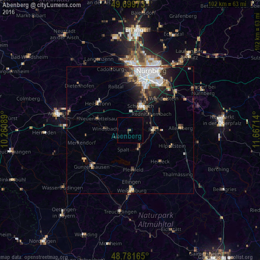
Analysis of Abenberg night lights 2016
Square area 10x10 km:
 0%
0%90-99
0%80-89
0%70-79
0%60-69
0.53%50-59
0.53%40-49
0%30-39
0.53%20-29
0.53%10-19
0%0-9
97.86%Square area 50x50 km:
1.95%90-99
1.41%80-89
0.53%70-79
0.62%60-69
1.02%50-59
1.01%40-49
0.93%30-39
1.23%20-29
1.93%10-19
3.11%0-9
86.28%Clear (daylight) street map image can be seen on geolist.org.
Map coordinates:
49° 41' 59" North, 10° 15' 39.2" East
49° 14' 34.2" North, 10° 57' 50.4" East
48° 46' 53.9" North, 11° 40' 1.7" East
Some cities around Abenberg sort by population:
• Schwabach
10.7 km =6.6 mi,  23°
23°
• Roth
9.2 km =5.7 mi,  86°
86°
• Neuendettelsau
13.9 km =8.6 mi,  288°
288°
• Rednitzhembach
10.6 km =6.6 mi,  52°
52°
• Georgensgmünd
7 km =4.3 mi,  147°
147°
• Windsbach
10 km =6.2 mi,  273°
273°
• Büchenbach
7.4 km =4.6 mi,  68°
68°
• Spalt
8 km =5 mi,  200°
200°
2959855 (p: 5,484)
Sources (retrieved 2019-11-25):
» Earth at Night: Flat Maps 2012, 2016