Nohfelden night lights from space
Night Light of Nohfelden (Saarland) from space (Germany) Src. Average luminocity for 10x10km area is 1.3207% and for 50x50km: 3.204%.
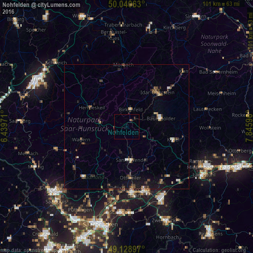
Analysis of Nohfelden night lights 2016
Square area 10x10 km:
 0%
0%90-99
0%80-89
0%70-79
0%60-69
0.56%50-59
0.7%40-49
0.7%30-39
0%20-29
0%10-19
0.84%0-9
97.2%Square area 50x50 km:
0.19%90-99
0.32%80-89
0.26%70-79
0.25%60-69
0.37%50-59
0.53%40-49
0.82%30-39
0.57%20-29
0.79%10-19
2.32%0-9
93.57%Clear (daylight) street map image can be seen on geolist.org.
Map coordinates:
50° 2' 26.3" North, 6° 26' 23" East
49° 35' 12.9" North, 7° 8' 34.2" East
49° 7' 44.3" North, 7° 50' 45.5" East
Some cities around Nohfelden sort by population:
• Sankt Wendel
13.5 km =8.4 mi,  172°
172°
• Tholey
13.8 km =8.6 mi,  213°
213°
• Marpingen
16.2 km =10.1 mi,  202°
202°
• Nonnweiler
12.7 km =7.9 mi,  280°
280°
• Freisen
8.8 km =5.5 mi,  117°
117°
• Namborn
7.3 km =4.5 mi,  181°
181°
• Birkenfeld
7.5 km =4.7 mi,  13°
13°
• Oberthal
9.3 km =5.8 mi, 207°
2862294 (p: 10,687)
Sources (retrieved 2019-11-25):
» Earth at Night: Flat Maps 2012, 2016