Birkenfeld night lights from space
Night Light of Birkenfeld (Rheinland-Pfalz) from space (Germany) Src. Average luminocity for 10x10km area is 2.9188% and for 50x50km: 1.846%.
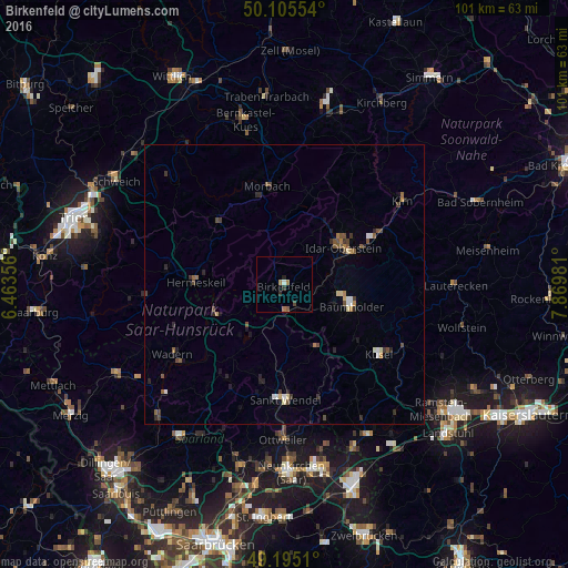
Analysis of Birkenfeld night lights 2016
Square area 10x10 km:
 0%
0%90-99
0.56%80-89
0%70-79
0.28%60-69
1.4%50-59
0.56%40-49
0.56%30-39
0.7%20-29
0.84%10-19
0.14%0-9
94.96%Square area 50x50 km:
0.14%90-99
0.18%80-89
0.19%70-79
0.12%60-69
0.24%50-59
0.35%40-49
0.48%30-39
0.35%20-29
0.48%10-19
0.46%0-9
97.02%Clear (daylight) street map image can be seen on geolist.org.
Map coordinates:
50° 6' 19.9" North, 6° 27' 48.8" East
49° 39' 8.8" North, 7° 10' 0" East
49° 11' 42.4" North, 7° 52' 11.3" East
Some cities around Birkenfeld sort by population:
• Idar-Oberstein
12.3 km =7.6 mi,  55°
55°
• Morbach
17.5 km =10.9 mi,  350°
350°
• Nohfelden
7.5 km =4.7 mi,  193°
193°
• Nonnweiler
15 km =9.3 mi,  250°
250°
• Freisen
12.9 km =8 mi,  152°
152°
• Namborn
14.7 km =9.1 mi, 187°
• Oberthal
16.7 km =10.4 mi,  201°
201°
• Hermeskeil
16 km =9.9 mi,  271°
271°
2948595 (p: 6,947)
Sources (retrieved 2019-11-25):
» Earth at Night: Flat Maps 2012, 2016