Nikolassee night lights from space
Night Light of Nikolassee (Berlin) from space (Germany) Src. Average luminocity for 10x10km area is 50.2879% and for 50x50km: 33.6344%.
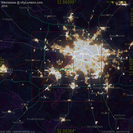
Analysis of Nikolassee night lights 2016
Square area 10x10 km:
 5.81%
5.81%90-99
9.72%80-89
8.33%70-79
7.07%60-69
9.22%50-59
5.56%40-49
5.3%30-39
9.34%20-29
24.87%10-19
14.77%0-9
0%Square area 50x50 km:
10.41%90-99
8.58%80-89
3.26%70-79
2.62%60-69
2.82%50-59
2.92%40-49
2.98%30-39
3.57%20-29
7.4%10-19
10.71%0-9
44.73%Clear (daylight) street map image can be seen on geolist.org.
Map coordinates:
52° 51' 39.6" North, 12° 29' 52.2" East
52° 26' 3.8" North, 13° 12' 3.4" East
52° 0' 13.1" North, 13° 54' 14.7" East
Some cities around Nikolassee sort by population:
• Zehlendorf
3.3 km =2.1 mi,  92°
92°
• Teltow
5.3 km =3.3 mi,  130°
130°
• Kleinmachnow
3.4 km =2.1 mi,  150°
150°
• Dahlem
6.4 km =4 mi,  65°
65°
• Kladow
4.4 km =2.7 mi,  299°
299°
• Stahnsdorf
5.8 km =3.6 mi,  169°
169°
• Grunewald
7 km =4.3 mi,  38°
38°
• Wannsee
3.5 km =2.2 mi,  241°
241°
2862423 (p: 16,194)
Sources (retrieved 2019-11-25):
» Earth at Night: Flat Maps 2012, 2016