Niederrad night lights from space
Night Light of Niederrad (Hesse) from space (Germany) Src. Average luminocity for 10x10km area is 75.4594% and for 50x50km: 30.1195%.
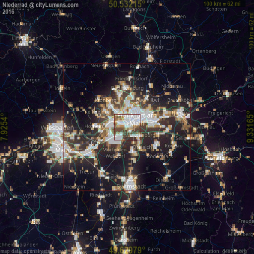
Analysis of Niederrad night lights 2016
Square area 10x10 km:
 29.97%
90-99
18.49%80-89
5.74%70-79
2.94%60-69
9.8%50-59
5.6%40-49
14.29%30-39
12.32%20-29
0.84%10-19
0%0-9
0%Square area 50x50 km:
6.17%90-99
6.08%80-89
2.62%70-79
2.87%60-69
3.61%50-59
2.92%40-49
4.23%30-39
5.28%20-29
10.81%10-19
16.67%0-9
38.75%Clear (daylight) street map image can be seen on geolist.org.
Map coordinates:
50° 31' 55.7" North, 7° 55' 31.4" East
50° 4' 59.1" North, 8° 37' 42.7" East
49° 37' 47.2" North, 9° 19' 53.9" East
Some cities around Niederrad sort by population:
• Frankfurt am Main
5.4 km =3.4 mi,  47°
47°
• Offenbach
10 km =6.2 mi,  78°
78°
• Dreieich
8.5 km =5.3 mi,  145°
145°
• Gallus
1.9 km =1.2 mi,  2°
2°
• Neu Isenburg
6.1 km =3.8 mi,  129°
129°
• Eschborn
7.8 km =4.8 mi,  328°
328°
• Kelsterbach
7.5 km =4.7 mi,  251°
251°
• Sulzbach
9.1 km =5.7 mi,  308°
308°
7290401 (p: 22,370)
Sources (retrieved 2019-11-25):
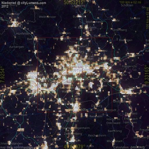
» Earth at Night: Flat Maps 2012, 2016