Eschborn night lights from space
Night Light of Eschborn (Hesse) from space (Germany) Src. Average luminocity for 10x10km area is 74.7152% and for 50x50km: 29.9457%.
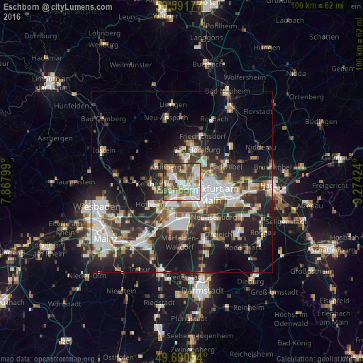
Analysis of Eschborn night lights 2016
Square area 10x10 km:
 19.79%
90-99
19.92%80-89
7.22%70-79
12.03%60-69
11.76%50-59
6.28%40-49
14.57%30-39
7.35%20-29
1.07%10-19
0%0-9
0%Square area 50x50 km:
6.66%90-99
6.48%80-89
2.65%70-79
2.62%60-69
3.2%50-59
2.68%40-49
4.17%30-39
5.23%20-29
10.37%10-19
14.79%0-9
41.15%Clear (daylight) street map image can be seen on geolist.org.
Map coordinates:
50° 35' 30.4" North, 7° 52' 4.8" East
50° 8' 35.8" North, 8° 34' 16" East
49° 41' 25.9" North, 9° 16' 27.3" East
Some cities around Eschborn sort by population:
• Gallus
6.3 km =3.9 mi,  138°
138°
• Bad Soden am Taunus
4.8 km =3 mi,  266°
266°
• Kronberg
5.7 km =3.5 mi,  323°
323°
• Kronberg Tal
6.3 km =3.9 mi,  309°
309°
• Schwalbach am Taunus
2.8 km =1.7 mi,  285°
285°
• Steinbach am Taunus
2.7 km =1.7 mi,  2°
2°
• Liederbach
6 km =3.7 mi,  246°
246°
• Sulzbach
3.2 km =2 mi, 251°
2929134 (p: 20,383)
Sources (retrieved 2019-11-25):
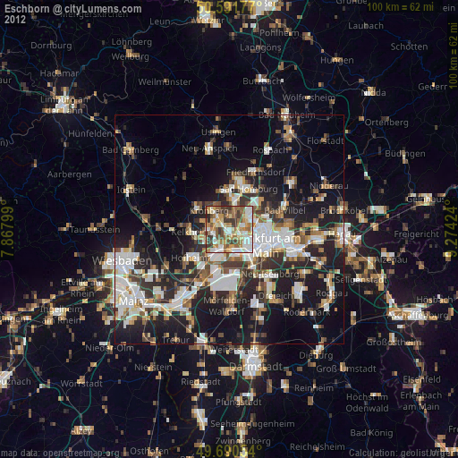
» Earth at Night: Flat Maps 2012, 2016